UN/LOCODE hub · India
INDLE

Dhule

20.9000°, 74.7833°
375,559
Population
1
Transport functions

Transport Functions

Multimodal
UN/LOCODE

Hub Profile

Place type
Provincial seat
GeoNames
Region
Maharashtra
GeoNames
Population
375,559
GeoNames
Time zone
Asia/Kolkata
GeoNames
Elevation
266 m
GeoNames

Location

Location of INDLE
Natural Earth 10m (public domain) · Maharashtra · INDLE · 20.90, 74.78GoogleOSMYandex

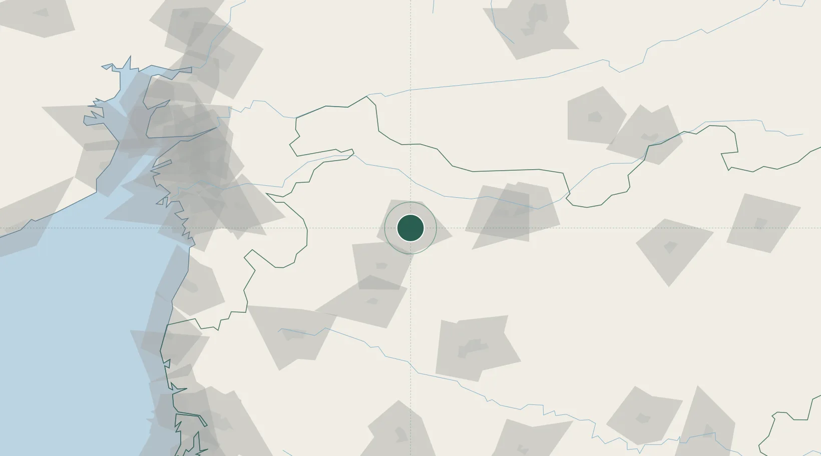
Nearby Logistics Neighbours

Cities
  1. 1Shahada79 km
  2. 2Sendhwa93 km
  3. 3Maliwada118 km
  4. 4Aurangabad127 km
  5. 5Sinnar143 km
Nearest neighbours — logibook spatial index (haversine) over the source coordinates
Ports
  1. 1Magdalla213 km
  2. 2Hazira224 km
  3. 3Dahej250 km
  4. 4Bhavnagar281 km
  5. 5Jawaharlal Nehru Port (Nhava Shiva)289 km
Nearest neighbours — logibook spatial index (haversine) over the source coordinates
Airports
  1. 1Jalgaon Airport88 km
  2. 2Nashik International Airport126 km
  3. 3Aurangabad Airport132 km
  4. 4Shirdi International Airport141 km
  5. 5Daman Airport208 km
Nearest neighbours — logibook spatial index (haversine) over the source coordinates
Trade Zones
  1. 1Ajanta Projects (India) Ltd.128 km
  2. 2Wockhardt Infrastructure Development Limited136 km
  3. 3Surat Apparel Park198 km
  4. 4HBS Pharma SEZ Private Limited, Bharuch199 km
  5. 5Surat Special Economic Zone200 km
Nearest neighbours — logibook spatial index (haversine) over the source coordinates
DatabookThe Record of Consolidated Knowledge
India beyond logistics?
Browse databook

All Sources

LocationsUN/LOCODE
UN/LOCODE — free
LocationsGeoNames
CC BY 4.0
Portsthe NGA World Port Index
Public domain (US gov)
AirportsOurAirports
Public domain
Trade Zonesthe World Bank SEZ database
CC BY 4.0
Trade ZonesOpen Zone Map
CC BY
← India locations