UN/LOCODE hub · Ireland
IEIBG

Ballincollig

51.8833°, -8.5833°
18,621
Population
1
Transport functions

Transport Functions

Multimodal
UN/LOCODE

Hub Profile

Place type
Populated place
GeoNames
Region
Munster
GeoNames
Population
18,621
GeoNames
Time zone
Europe/Dublin
GeoNames
Elevation
27 m
GeoNames

Location

Location of IEIBG
Natural Earth 10m (public domain) · Munster · IEIBG · 51.88, -8.58GoogleOSMYandex

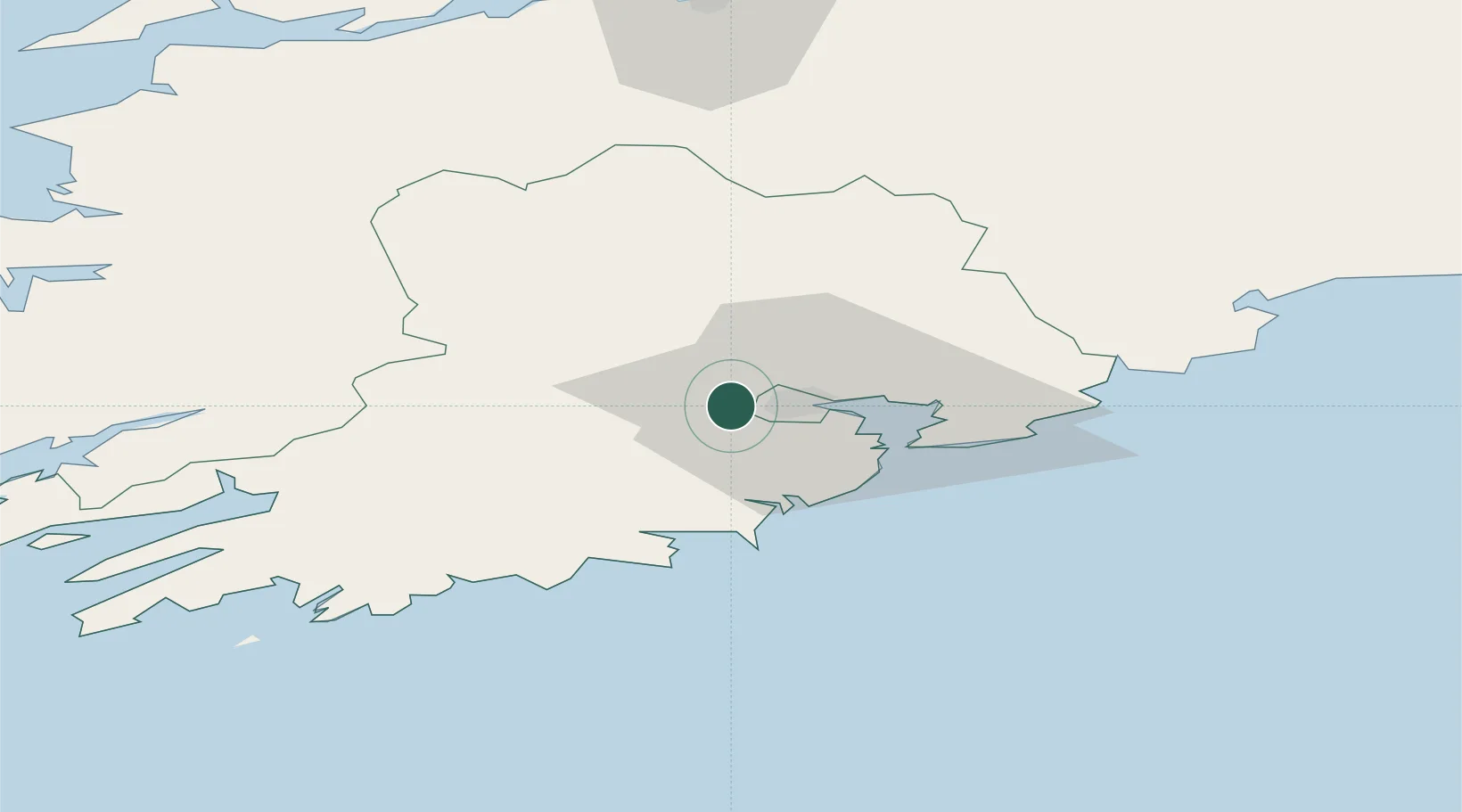
Nearby Logistics Neighbours

Cities
  1. 1Waterfall4 km
  2. 2Ford's Wharf (Topaz Energy Terminal)10 km
  3. 3Cork14 km
  4. 4Little Island/Cork16 km
  5. 5Passage West16 km
Nearest neighbours — logibook spatial index (haversine) over the source coordinates
Ports
  1. 1Cobh20 km
  2. 2Cork22 km
  3. 3Bantry64 km
  4. 4Limerick83 km
  5. 5Foynes89 km
Nearest neighbours — logibook spatial index (haversine) over the source coordinates
Airports
  1. 1Cork International Airport8 km
  2. 2Kerry Airport72 km
  3. 3Shannon Airport94 km
  4. 4Waterford Airport108 km
  5. 5Inisheer Aerodrome146 km
Nearest neighbours — logibook spatial index (haversine) over the source coordinates
Trade Zones
  1. 1Shannon Free Zone94 km
  2. 2Dublin International Financial Services Centre227 km
  3. 3Cornwall Newquay Aerohub Enterprise Zone298 km
  4. 4Oceansgate Plymouth350 km
  5. 5Heart of the South West Enterprise Zone354 km
Nearest neighbours — logibook spatial index (haversine) over the source coordinates
DatabookThe Record of Consolidated Knowledge
Ireland beyond logistics?
Browse databook

All Sources

LocationsUN/LOCODE
UN/LOCODE — free
LocationsGeoNames
CC BY 4.0
Portsthe NGA World Port Index
Public domain (US gov)
AirportsOurAirports
Public domain
Trade Zonesthe World Bank SEZ database
CC BY 4.0
Trade ZonesOpen Zone Map
CC BY
← Ireland locations