UN/LOCODE hub · Indonesia
IDTNJ

Tanjungpinang

0.9167°, 104.4500°
227,663
Population
2
Transport functions

Transport Functions

Port
Airport
Tanjungpinang is also a profiled seaport →
UN/LOCODE

Hub Profile

Place type
Provincial seat
GeoNames
Region
Riau Islands
GeoNames
Population
227,663
GeoNames
Time zone
Asia/Jakarta
GeoNames
Elevation
39 m
GeoNames

Location

Location of IDTNJ
Natural Earth 10m (public domain) · Riau Islands · IDTNJ · 0.92, 104.45GoogleOSMYandex

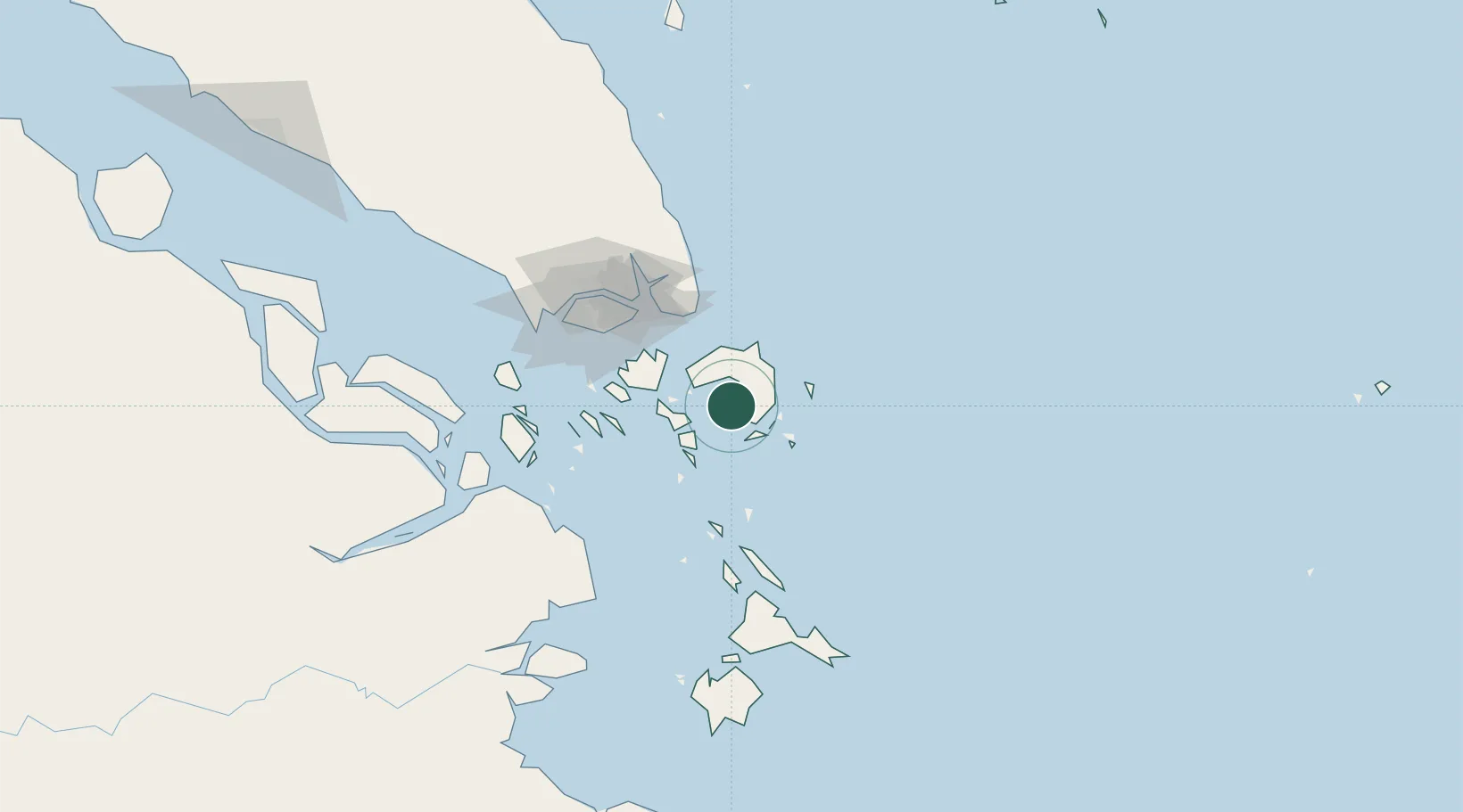
Nearby Logistics Neighbours

Cities
  1. 1Kidjang, Bintan19 km
  2. 2Lobam22 km
  3. 3Tanjunguban28 km
  4. 4Batam Island56 km
  5. 5Batu Ampar57 km
Nearest neighbours — logibook spatial index (haversine) over the source coordinates
Ports
  1. 1Kijang18 km
  2. 2Tanjunguban31 km
  3. 3Sekupang64 km
  4. 4Pulau Sambu67 km
  5. 5Keppel - (East Singapore)78 km
Nearest neighbours — logibook spatial index (haversine) over the source coordinates
Airports
  1. 1Raja Haji Fisabilillah International Airport9 km
  2. 2Hang Nadim International Airport43 km
  3. 3Changi Air Base (East)68 km
  4. 4Singapore Changi Airport70 km
  5. 5Paya Lebar Air Base78 km
Nearest neighbours — logibook spatial index (haversine) over the source coordinates
Trade Zones
  1. 1Bintan Industrial Estate23 km
  2. 2KEK Galang Batang23 km
  3. 3Kabil Integrated Industrial Estate (KIIE)41 km
  4. 4Taiwan International Industrial Estate42 km
  5. 5Batam-Bintan-Karimun Free Trade Zone47 km
Nearest neighbours — logibook spatial index (haversine) over the source coordinates
DatabookThe Record of Consolidated Knowledge
Indonesia beyond logistics?
Browse databook

All Sources

LocationsUN/LOCODE
UN/LOCODE — free
LocationsGeoNames
CC BY 4.0
Portsthe NGA World Port Index
Public domain (US gov)
AirportsOurAirports
Public domain
Trade Zonesthe World Bank SEZ database
CC BY 4.0
Trade ZonesOpen Zone Map
CC BY
← Indonesia locations