UN/LOCODE hub · Indonesia
IDSUA

Suaran

2.0500°, 117.7000°
1
Transport functions

Transport Functions

Port
UN/LOCODE

Hub Profile

Region
KI
GeoNames

Location

Location of IDSUA
Natural Earth 10m (public domain) · KI · IDSUA · 2.05, 117.70GoogleOSMYandex

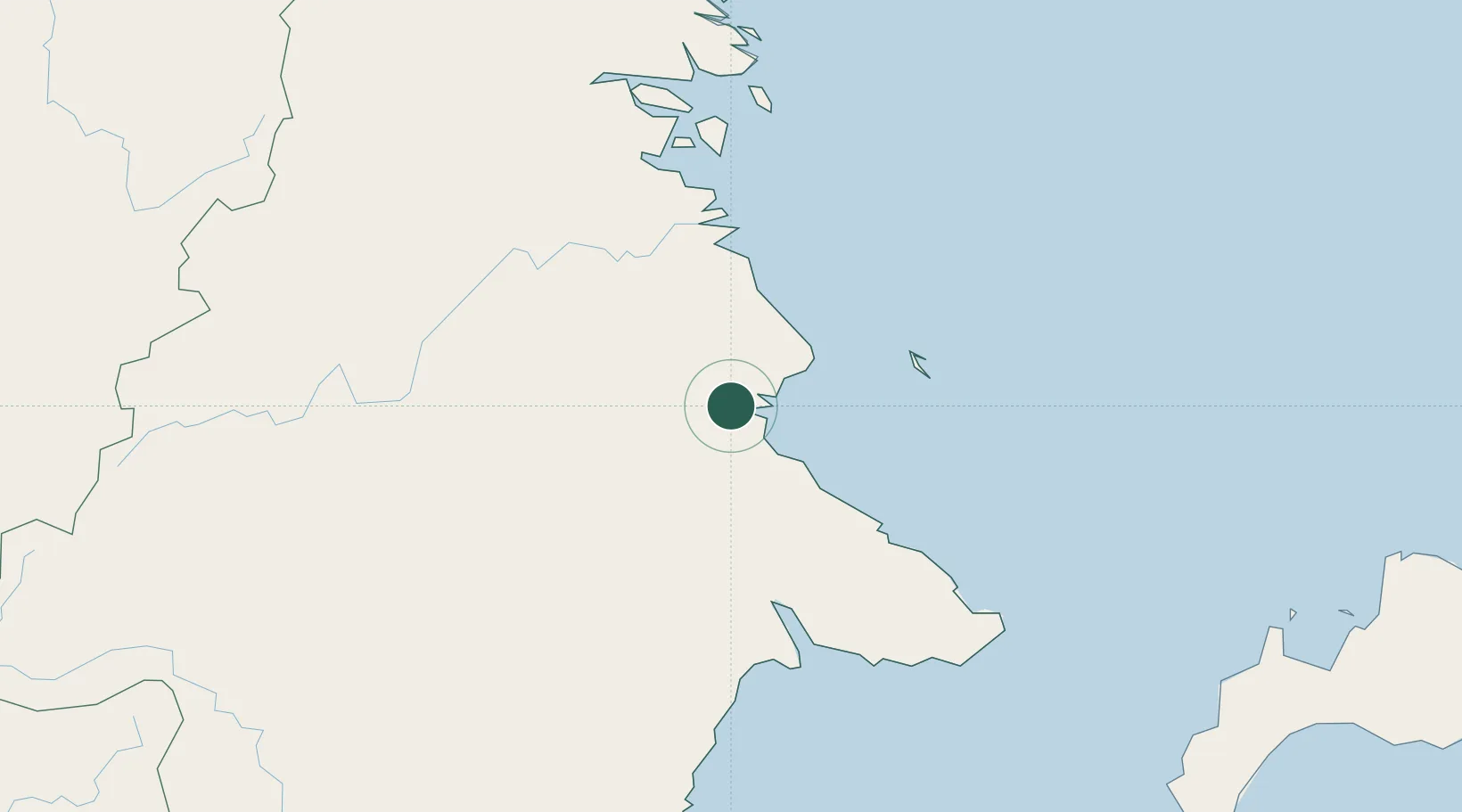
Nearby Logistics Neighbours

Cities
  1. 1Mangkajang10 km
  2. 2Tarakan, Kalimantan138 km
  3. 3Lubuk Tutung143 km
  4. 4Bunyu162 km
  5. 5Tanjung Merangas225 km
Nearest neighbours — logibook spatial index (haversine) over the source coordinates
Ports
  1. 1Tanjung Arang (Bunyu)158 km
  2. 2Tanjung Sangata188 km
  3. 3Bontang Lng Terminal218 km
  4. 4Tawa246 km
  5. 5Mostyn299 km
Nearest neighbours — logibook spatial index (haversine) over the source coordinates
Airports
  1. 1Kalimarau Airport32 km
  2. 2Tanjung Harapan Airport95 km
  3. 3Juwata International Airport / Suharnoko Harbani AFB143 km
  4. 4Robert Atty Bessing208 km
  5. 5LNG Badak Airport216 km
Nearest neighbours — logibook spatial index (haversine) over the source coordinates
Trade Zones
  1. 1Maloy Batuta Trans Kalimantan Special Economic Zone140 km
  2. 2Muara Wahau Industrial Park149 km
  3. 3Kaltim Industrial Estate209 km
  4. 4Delma Industrial Park220 km
  5. 5Kariangau Industrial Estate382 km
Nearest neighbours — logibook spatial index (haversine) over the source coordinates
DatabookThe Record of Consolidated Knowledge
Indonesia beyond logistics?
Browse databook

All Sources

LocationsUN/LOCODE
UN/LOCODE — free
Portsthe NGA World Port Index
Public domain (US gov)
AirportsOurAirports
Public domain
Trade Zonesthe World Bank SEZ database
CC BY 4.0
Trade ZonesOpen Zone Map
CC BY
← Indonesia locations