UN/LOCODE hub · United Kingdom
GBGIG

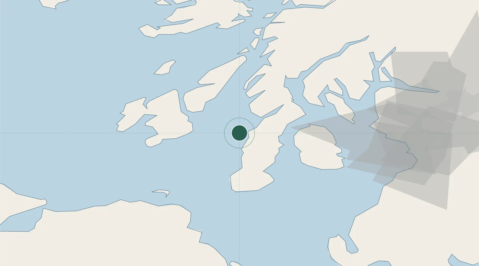
Ardminish, Gigha Island

55.6667°, -5.7333°
2
Transport functions

Transport Functions

Port
Road
UN/LOCODE

Hub Profile

Region
AGB
GeoNames

Location

Location of GBGIG
Natural Earth 10m (public domain) · AGB · GBGIG · 55.67, -5.73GoogleOSMYandex

Nearby Logistics Neighbours

Cities
  1. 1Tayinloan6 km
  2. 2Muasdale9 km
  3. 3Carradale19 km
  4. 4Kennacraig22 km
  5. 5Craighouse, Isle of Jura23 km
Nearest neighbours — logibook spatial index (haversine) over the source coordinates
Ports
  1. 1Campbeltown27 km
  2. 2Port Ellen30 km
  3. 3Lamlash Harbor42 km
  4. 4Ardrishaig43 km
  5. 5Rothesay Harbor47 km
Nearest neighbours — logibook spatial index (haversine) over the source coordinates
Airports
  1. 1Campbeltown Airport26 km
  2. 2Islay Airport33 km
  3. 3Colonsay Airstrip54 km
  4. 4Glasgow Prestwick Airport75 km
  5. 5Glasgow Airport85 km
Nearest neighbours — logibook spatial index (haversine) over the source coordinates
Trade Zones
  1. 1Prestwick Airport Free Zone73 km
  2. 2Isle of Man Free Zone and Business Park189 km
  3. 3Carlisle Kingmoor Park Enterprise Zone193 km
  4. 4Dublin International Financial Services Centre260 km
  5. 5Blackpool Enterprise Zone273 km
Nearest neighbours — logibook spatial index (haversine) over the source coordinates
DatabookThe Record of Consolidated Knowledge
United Kingdom beyond logistics?
Browse databook

All Sources

LocationsUN/LOCODE
UN/LOCODE — free
Portsthe NGA World Port Index
Public domain (US gov)
AirportsOurAirports
Public domain
Trade Zonesthe World Bank SEZ database
CC BY 4.0
Trade ZonesOpen Zone Map
CC BY
← United Kingdom locations