UN/LOCODE hub · Djibouti
DJCLA

Camp Lemonier

11.5333°, 43.1333°
1
Transport functions

Transport Functions

Multimodal
UN/LOCODE

Location

Location of DJCLA
Natural Earth 10m (public domain) · Arta · DJCLA · 11.53, 43.13GoogleOSMYandex

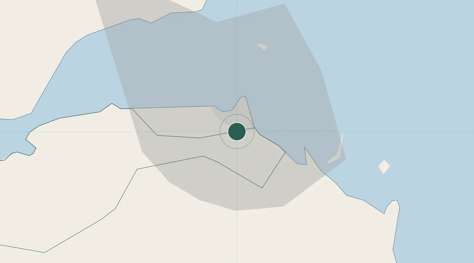
Nearby Logistics Neighbours

Cities
  1. 1Djibouti6 km
  2. 2Damerjog8 km
  3. 3Djibouti8 km
  4. 4Perim Island128 km
  5. 5Doraleh Container Terminal160 km
Nearest neighbours — logibook spatial index (haversine) over the source coordinates
Ports
  1. 1Djibouti7 km
  2. 2Doraleh9 km
  3. 3Assab168 km
  4. 4Al Mukha199 km
  5. 5Berbera238 km
Nearest neighbours — logibook spatial index (haversine) over the source coordinates
Airports
  1. 1Djibouti-Ambouli Airport3 km
  2. 2Assab International Airport179 km
  3. 3Mokha International Airport196 km
  4. 4Berbera Airport235 km
  5. 5Semera Airport235 km
Nearest neighbours — logibook spatial index (haversine) over the source coordinates
Trade Zones
  1. 1Touchroad Djibouti Special Economic Zone5 km
  2. 2Djibouti Free Zone6 km
  3. 3UKAB Holdings Free Zone10 km
  4. 4Damerjog Industrial Development Free Zone12 km
  5. 5Assab Free Trade Zone168 km
Nearest neighbours — logibook spatial index (haversine) over the source coordinates
DatabookThe Record of Consolidated Knowledge
Djibouti beyond logistics?
Browse databook

All Sources

LocationsUN/LOCODE
UN/LOCODE — free
Portsthe NGA World Port Index
Public domain (US gov)
AirportsOurAirports
Public domain
Trade Zonesthe World Bank SEZ database
CC BY 4.0
Trade ZonesOpen Zone Map
CC BY
← Djibouti locations