UN/LOCODE hub · Germany
DEZAX

Lutherstadt Wittenberg

51.8667°, 12.6500°
1
Transport functions

Transport Functions

Multimodal
UN/LOCODE

Hub Profile

Region
ST
GeoNames

Location

Location of DEZAX
Natural Earth 10m (public domain) · ST · DEZAX · 51.87, 12.65GoogleOSMYandex

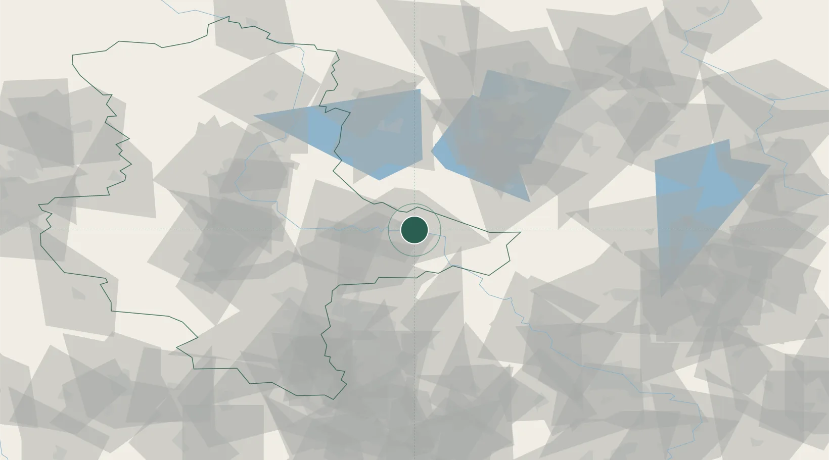
Nearby Logistics Neighbours

Cities
  1. 1Piesteritz3 km
  2. 2Gallin8 km
  3. 3Bergwitz9 km
  4. 4Zahna11 km
  5. 5Elster13 km
Nearest neighbours — logibook spatial index (haversine) over the source coordinates
Ports
  1. 1Szczecin215 km
  2. 2Police229 km
  3. 3Wismar240 km
  4. 4Rostock251 km
  5. 5Swinoujscie252 km
Nearest neighbours — logibook spatial index (haversine) over the source coordinates
Airports
  1. 1Holzdorf Air Base37 km
  2. 2Zerbst Airfield38 km
  3. 3Leipzig/Halle Airport57 km
  4. 4Berlin Brandenburg Airport80 km
  5. 5Leipzig–Altenburg Airport99 km
Nearest neighbours — logibook spatial index (haversine) over the source coordinates
Trade Zones
  1. 1Kostrzyń-Słubice SEZ158 km
  2. 2Most - Joseph Industrial Zone169 km
  3. 3Žatec - Triangle Strategic Industrial Zone175 km
  4. 4Podbořany Industrial Zone190 km
  5. 5Szczecin Duty Free Zone216 km
Nearest neighbours — logibook spatial index (haversine) over the source coordinates
DatabookThe Record of Consolidated Knowledge
Germany beyond logistics?
Browse databook

All Sources

LocationsUN/LOCODE
UN/LOCODE — free
Portsthe NGA World Port Index
Public domain (US gov)
AirportsOurAirports
Public domain
Trade Zonesthe World Bank SEZ database
CC BY 4.0
Trade ZonesOpen Zone Map
CC BY
← Germany locations