UN/LOCODE hub · Germany
DEAPH

Aspach

48.9667°, 9.4000°
8,131
Population
1
Transport functions

Transport Functions

Multimodal
UN/LOCODE

Hub Profile

Place type
Local administrative seat
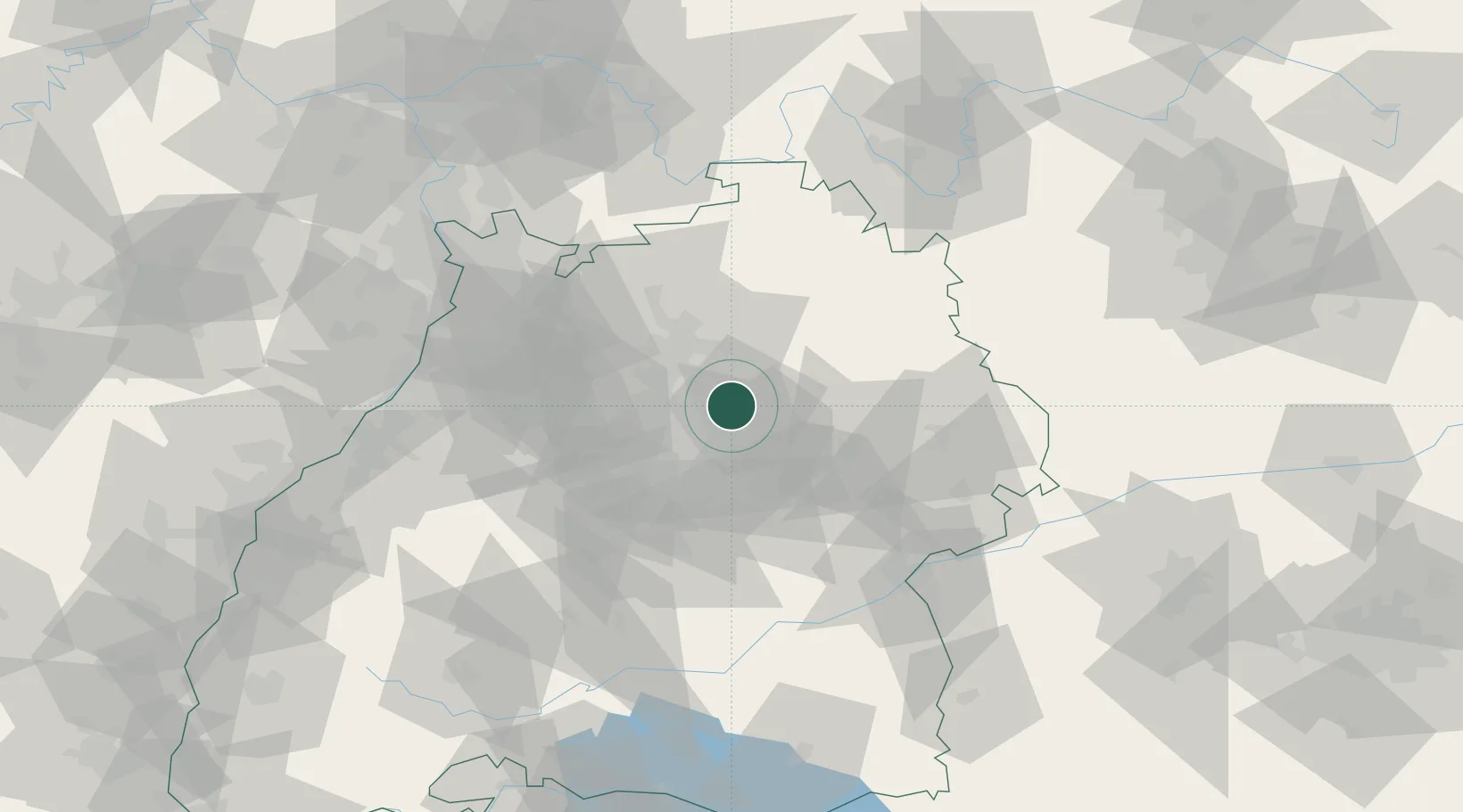
GeoNames
Region
Baden-Wurttemberg
GeoNames
Population
8,131
GeoNames
Time zone
Europe/Berlin
GeoNames
Elevation
280 m
GeoNames

Location

Location of DEAPH
Natural Earth 10m (public domain) · Baden-Wurttemberg · DEAPH · 48.97, 9.40GoogleOSMYandex

Nearby Logistics Neighbours

Cities
  1. 1Oppenweiler4 km
  2. 2Spiegelberg8 km
  3. 3Sulzbach an der Murr8 km
  4. 4Auenwald8 km
  5. 5Winnenden9 km
Nearest neighbours — logibook spatial index (haversine) over the source coordinates
Ports
  1. 1Bruxelles419 km
  2. 2Antwerpen436 km
  3. 3Nogaro456 km
  4. 4Porto Di Lido-Venezia456 km
  5. 5Dordrecht462 km
Nearest neighbours — logibook spatial index (haversine) over the source coordinates
Airports
  1. 1Adolf Würth Airport33 km
  2. 2Stuttgart Airport33 km
  3. 3Niederstetten Army Air Base62 km
  4. 4Mannheim-City Airport86 km
  5. 5Laupheim Air Base91 km
Nearest neighbours — logibook spatial index (haversine) over the source coordinates
Trade Zones
  1. 1ZFU Neuhof129 km
  2. 2ZFU Hautepierre132 km
  3. 3ZFU La Cité Behren-lès-Forbach182 km
  4. 4ZFU Mulhouse204 km
  5. 5ZFU Metz237 km
Nearest neighbours — logibook spatial index (haversine) over the source coordinates
DatabookThe Record of Consolidated Knowledge
Germany beyond logistics?
Browse databook

All Sources

LocationsUN/LOCODE
UN/LOCODE — free
LocationsGeoNames
CC BY 4.0
Portsthe NGA World Port Index
Public domain (US gov)
AirportsOurAirports
Public domain
Trade Zonesthe World Bank SEZ database
CC BY 4.0
Trade ZonesOpen Zone Map
CC BY
← Germany locations