UN/LOCODE hub · China
CNNDE

Ningde

26.7215°, 119.5824°
429,260
Population
1
Transport functions

Transport Functions

Port
UN/LOCODE

Hub Profile

Place type
Provincial seat
GeoNames
Region
Fujian
GeoNames
Population
429,260
GeoNames
Time zone
Asia/Shanghai
GeoNames
Elevation
20 m
GeoNames
Logistics facilities
2
UN/LOCODE

Location

Location of CNNDE
Natural Earth 10m (public domain) · Fujian · CNNDE · 26.72, 119.58GoogleOSMYandex

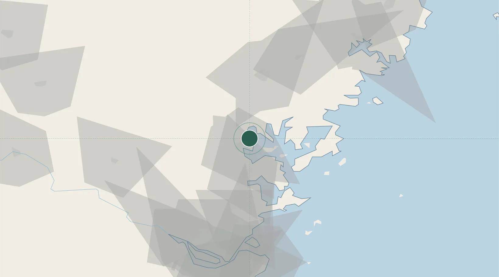
Nearby Logistics Neighbours

Cities
  1. 1Zhangwan2 km
  2. 2Shacheng10 km
  3. 3Saiqi29 km
  4. 4Luoyuanwan36 km
  5. 5Dongdaiwan54 km
Nearest neighbours — logibook spatial index (haversine) over the source coordinates
Ports
  1. 1Fuzhou76 km
  2. 2Xiuyu176 km
  3. 3Wenzhou179 km
  4. 4Quanzhou227 km
  5. 5Tan-Shui250 km
Nearest neighbours — logibook spatial index (haversine) over the source coordinates
Airports
  1. 1Matsu Beigan Airport69 km
  2. 2Matsu Nangan Airport73 km
  3. 3Fuzhou Zhuqi Heliport81 km
  4. 4Fuzhou Air Base84 km
  5. 5Fuzhou Changle International Airport89 km
Nearest neighbours — logibook spatial index (haversine) over the source coordinates
Trade Zones
  1. 1Sanduao Economic Development Zone10 km
  2. 2Luoyuan Bay Economic Development Zone27 km
  3. 3Gutian Industrial Park29 km
  4. 4Fuan Economic Development Zone30 km
  5. 5Xiapu Economic Development Zone48 km
Nearest neighbours — logibook spatial index (haversine) over the source coordinates
DatabookThe Record of Consolidated Knowledge
China beyond logistics?
Browse databook

All Sources

LocationsUN/LOCODE
UN/LOCODE — free
LocationsGeoNames
CC BY 4.0
Portsthe NGA World Port Index
Public domain (US gov)
AirportsOurAirports
Public domain
Trade Zonesthe World Bank SEZ database
CC BY 4.0
Trade ZonesOpen Zone Map
CC BY
← China locations