UN/LOCODE hub · Bhutan
BTLMZ

Lhamoizingkha

26.7000°, 89.8333°
2
Transport functions

Transport Functions

Road
Multimodal
UN/LOCODE

Hub Profile

Region
22
GeoNames

Location

Location of BTLMZ
Natural Earth 10m (public domain) · 22 · BTLMZ · 26.70, 89.83GoogleOSMYandex

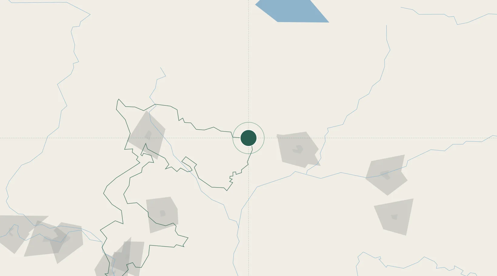
Nearby Logistics Neighbours

Cities
  1. 1Samtse23 km
  2. 2Pasakha44 km
  3. 3Sarpang46 km
  4. 4Phuentsholing49 km
  5. 5Nyonpaling63 km
Nearest neighbours — logibook spatial index (haversine) over the source coordinates
Ports
  1. 1Mongla471 km
  2. 2Calcutta486 km
  3. 3Chittagong527 km
  4. 4Haldia Port550 km
  5. 5Dhamra716 km
Nearest neighbours — logibook spatial index (haversine) over the source coordinates
Airports
  1. 1Hashimara Air Force Station46 km
  2. 2Gelephu Airport66 km
  3. 3Paro International Airport88 km
  4. 4Baljek Airport126 km
  5. 5Bathpalathang Airport132 km
Nearest neighbours — logibook spatial index (haversine) over the source coordinates
Trade Zones
  1. 1Jigmeling Industrial Park47 km
  2. 2Dhamdum Industrial Park79 km
  3. 3Kurigram Economic Zone - 1101 km
  4. 4Debiganj Economic Zone: Sujon125 km
  5. 5Panchagarh Economic Zone126 km
Nearest neighbours — logibook spatial index (haversine) over the source coordinates
DatabookThe Record of Consolidated Knowledge
Bhutan beyond logistics?
Browse databook

All Sources

LocationsUN/LOCODE
UN/LOCODE — free
Portsthe NGA World Port Index
Public domain (US gov)
AirportsOurAirports
Public domain
Trade Zonesthe World Bank SEZ database
CC BY 4.0
Trade ZonesOpen Zone Map
CC BY
← Bhutan locations