UN/LOCODE hub · Brazil
BRPNX

Panorama

-21.3500°, -51.8500°
14,964
Population
2
Transport functions

Transport Functions

Port
Road
UN/LOCODE

Hub Profile

Place type
Populated place
GeoNames
Region
São Paulo
GeoNames
Population
14,964
GeoNames
Time zone
America/Sao_Paulo
GeoNames
Elevation
295 m
GeoNames

Location

Location of BRPNX
Natural Earth 10m (public domain) · São Paulo · BRPNX · -21.35, -51.85GoogleOSMYandex

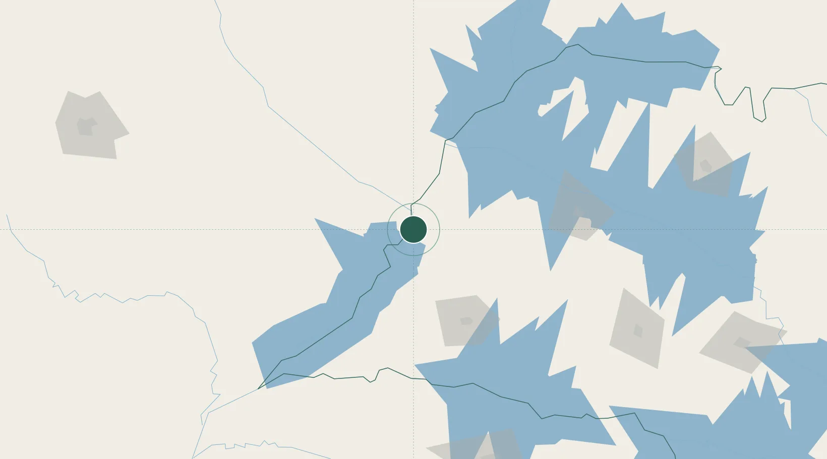
Nearby Logistics Neighbours

Cities
  1. 1Presidente Epitácio53 km
  2. 2Três Lagoas65 km
  3. 3Ilha Solteira117 km
  4. 4Araçatuba148 km
  5. 5Aparecida do Taboado162 km
Nearest neighbours — logibook spatial index (haversine) over the source coordinates
Ports
  1. 1Paranagua573 km
  2. 2Sao Francisco636 km
  3. 3Santos639 km
  4. 4Itajai700 km
  5. 5Sao Sebastiao716 km
Nearest neighbours — logibook spatial index (haversine) over the source coordinates
Airports
  1. 1Plínio Alarcom Airport69 km
  2. 2Presidente Prudente Airport102 km
  3. 3Araçatuba Airport150 km
  4. 4Frank Miloye Milenkowichi–Marília State Airport220 km
  5. 5Fazenda Mimosa Airport222 km
Nearest neighbours — logibook spatial index (haversine) over the source coordinates
Trade Zones
  1. 1ZPE de Bataguassú (MS)69 km
  2. 2ZPE de Fernandópolis (SP)201 km
  3. 3ZPE de Uberaba (MG)443 km
  4. 4Zona Franca Internacional545 km
  5. 5Zona Franca Global546 km
Nearest neighbours — logibook spatial index (haversine) over the source coordinates
DatabookThe Record of Consolidated Knowledge
Brazil beyond logistics?
Browse databook

All Sources

LocationsUN/LOCODE
UN/LOCODE — free
LocationsGeoNames
CC BY 4.0
Portsthe NGA World Port Index
Public domain (US gov)
AirportsOurAirports
Public domain
Trade Zonesthe World Bank SEZ database
CC BY 4.0
Trade ZonesOpen Zone Map
CC BY
← Brazil locations