UN/LOCODE hub · Australia
AUMAO

Marayong

-33.7500°, 150.9000°
7,675
Population
1
Transport functions

Transport Functions

Multimodal
UN/LOCODE

Hub Profile

Place type
Urban district
GeoNames
Region
New South Wales
GeoNames
Population
7,675
GeoNames
Time zone
Australia/Sydney
GeoNames
Elevation
35 m
GeoNames

Location

Location of AUMAO
Natural Earth 10m (public domain) · New South Wales · AUMAO · -33.75, 150.90GoogleOSMYandex

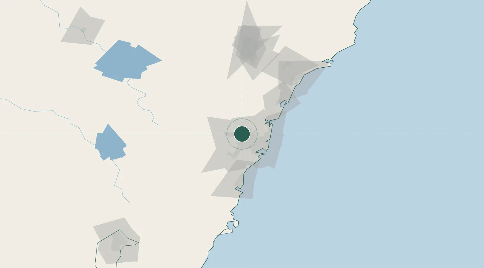
Nearby Logistics Neighbours

Cities
  1. 1Blacktown2 km
  2. 2Kings Park2 km
  3. 3Arndell Park5 km
  4. 4Glendenning5 km
  5. 5Pendle Hills7 km
Nearest neighbours — logibook spatial index (haversine) over the source coordinates
Ports
  1. 1Sydney31 km
  2. 2Botany Bay42 km
  3. 3Port Kembla82 km
  4. 4Newcastle124 km
  5. 5Jervis Bay152 km
Nearest neighbours — logibook spatial index (haversine) over the source coordinates
Airports
  1. 1RAAF Base Richmond20 km
  2. 2Sydney Bankstown Airport21 km
  3. 3Sydney Kingsford Smith International Airport34 km
  4. 4Camden Airport38 km
  5. 5Palm Beach Seaplane Base43 km
Nearest neighbours — logibook spatial index (haversine) over the source coordinates
Trade Zones
  1. 1Latrobe Valley Economic Growth Zone643 km
  2. 2Hicks Bay Area Special Economic Zone2488 km
  3. 3Vanuatu Economic Development Zone2604 km
  4. 4Paga Hill Estate Special Economic Zone2726 km
  5. 5Tulagi Island Special Economic Zone2899 km
Nearest neighbours — logibook spatial index (haversine) over the source coordinates
DatabookThe Record of Consolidated Knowledge
Australia beyond logistics?
Browse databook

All Sources

LocationsUN/LOCODE
UN/LOCODE — free
LocationsGeoNames
CC BY 4.0
Portsthe NGA World Port Index
Public domain (US gov)
AirportsOurAirports
Public domain
Trade Zonesthe World Bank SEZ database
CC BY 4.0
Trade ZonesOpen Zone Map
CC BY
← Australia locations