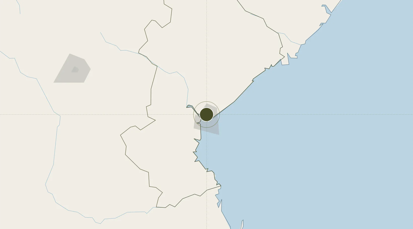
Diversified Zone · Mozambique

Manga-Mungassa (Beira) Special Economic Zone Active

-19.7408°, 34.8684°
217 ha
Zone area
10.9 km
Nearest port
7.4 km
Nearest airport

Gateway access

Nearest neighbours — logibook spatial index (haversine) over the source coordinates

Zone profile

Zone type
Diversified Zone
Open Zone Map
Region
Sofala
Open Zone Map
Status
Active
Open Zone Map
Management
Private
Open Zone Map
Operator
Dingsheng Internacional Investimento Lda.
Open Zone Map
Legal framework
Decree 22/2012 of 6 July 2012
Open Zone Map

Location

Location of ozm-2882
Natural Earth 10m (public domain) · Sofala · ozm-2882 · -19.74, 34.87GoogleOSMYandex

Nearby Logistics Neighbours

Ports
  1. 1Beira11 km
  2. 2Chinde215 km
  3. 3Quelimane296 km
  4. 4Porto Belo333 km
  5. 5Pebane442 km
Nearest neighbours — logibook spatial index (haversine) over the source coordinates
Airports
  1. 1Beira International Airport7 km
  2. 2Chimoio Airport165 km
  3. 3Bazaruto Island Airport210 km
  4. 4Indigo Bay Lodge Airport227 km
  5. 5Benguera Island Airport242 km
Nearest neighbours — logibook spatial index (haversine) over the source coordinates
Cities
  1. 1Beira5 km
  2. 2Chimanimani210 km
  3. 3Mutare246 km
  4. 4Rusape319 km
  5. 5Chiredzi364 km
Nearest neighbours — logibook spatial index (haversine) over the source coordinates
Trade Zones
  1. 1Manga-Mungassa Special Economic Zone8 km
  2. 2Fern Hill Special Economic Zone250 km
  3. 3Mocuba Industrial Free Zone398 km
  4. 4Ecosoft Special Economic Zone422 km
  5. 5Revúboè (Revubue) Industrial Free Zone423 km
Nearest neighbours — logibook spatial index (haversine) over the source coordinates
DatabookThe Record of Consolidated Knowledge
Mozambique beyond logistics?
Browse databook

All Sources

Trade ZonesOpen Zone Map
CC BY
Portsthe NGA World Port Index
Public domain (US gov)
AirportsOurAirports
Public domain
LocationsUN/LOCODE
UN/LOCODE — free
← Mozambique trade zones