Charter City · India
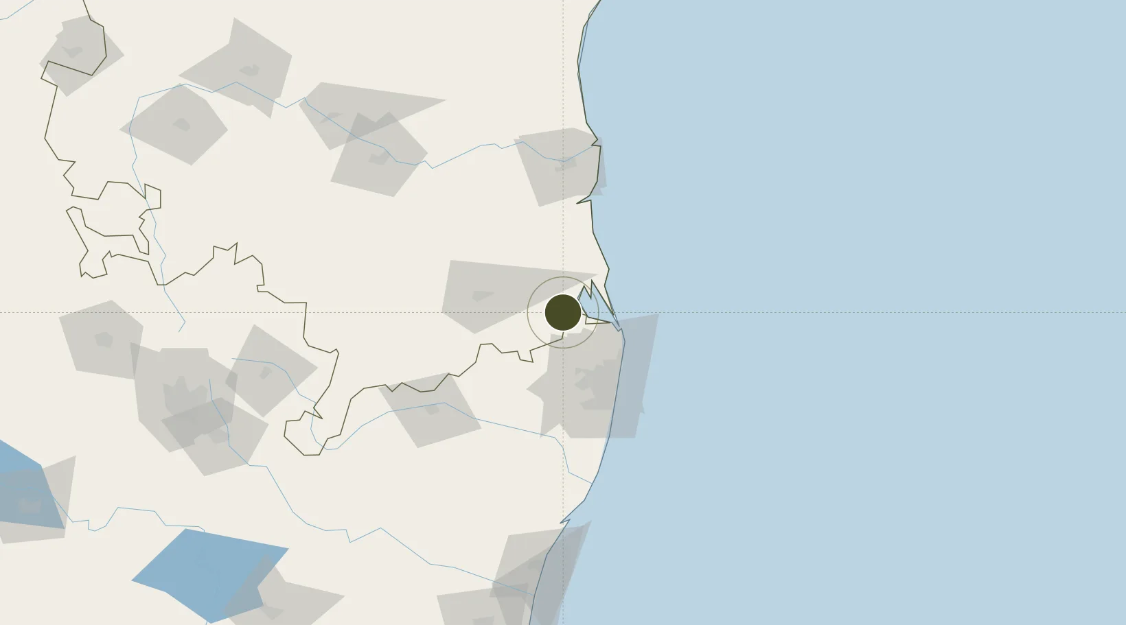
Sri City Active

13.5300°, 79.9633°
1,089 ha
Zone area
50.7 km
Nearest port
47.2 km
Nearest airport

Gateway access

Nearest neighbours — logibook spatial index (haversine) over the source coordinates

Zone profile

Zone type
Charter City
Open Zone Map
Region
Andhra Pradesh
Open Zone Map
Status
Active
Open Zone Map
Management
Private
Open Zone Map
Operator
Sri City Private Limited
Open Zone Map
Legal framework
Andhra Pradesh Bill No. 51 of 2005
Open Zone Map

Location

Location of ozm-2122
Natural Earth 10m (public domain) · Andhra Pradesh · ozm-2122 · 13.53, 79.96GoogleOSMYandex

Nearby Logistics Neighbours

Ports
  1. 1Kamarajar Port51 km
  2. 2Chennai (Madras)60 km
  3. 3Kattupalli Port82 km
  4. 4Pondicherry178 km
  5. 5Cuddalore203 km
Nearest neighbours — logibook spatial index (haversine) over the source coordinates
Airports
  1. 1Tirupati International Airport47 km
  2. 2Chennai International Airport64 km
  3. 3Kadapa Airport169 km
  4. 4Pondicherry Airport175 km
  5. 5Sri Sathya Sai Airport244 km
Nearest neighbours — logibook spatial index (haversine) over the source coordinates
Cities
  1. 1Sri City Pvt Ltd-SEZ/Satyavedu11 km
  2. 2LTSL SEZ/Tiruvallur43 km
  3. 3Tiruvallur43 km
  4. 4Mylapore47 km
  5. 5Chennai (ex Madras)48 km
Nearest neighbours — logibook spatial index (haversine) over the source coordinates
Trade Zones
  1. 1State Industries Promotion Corporation of Tamil Nadu Limited61 km
  2. 2Tril Info Park61 km
  3. 3New Chennai Developers Llp61 km
  4. 4DLF Info City61 km
  5. 5L & T Shipbuilding61 km
Nearest neighbours — logibook spatial index (haversine) over the source coordinates
DatabookThe Record of Consolidated Knowledge
India beyond logistics?
Browse databook

All Sources

Trade ZonesOpen Zone Map
CC BY
Portsthe NGA World Port Index
Public domain (US gov)
AirportsOurAirports
Public domain
LocationsUN/LOCODE
UN/LOCODE — free
← India trade zones