Diversified Zone · India

Falta Special Economic Zone Active
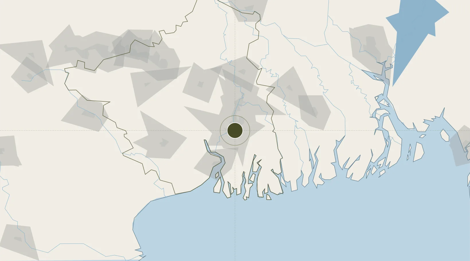
22.5617°, 88.3676°
110 ha
Zone area
3.8 km
Nearest port
13.1 km
Nearest airport

Gateway access

Nearest neighbours — logibook spatial index (haversine) over the source coordinates

Zone profile

Zone type
Diversified Zone
Open Zone Map
Region
West Bengal
Open Zone Map
Status
Active
Open Zone Map
Management
Public
Open Zone Map
Operator
the Government of India
Open Zone Map
Legal framework
West Bengal Special Economic Zones Act 2003
Open Zone Map

Location

Location of ozm-2104
Natural Earth 10m (public domain) · West Bengal · ozm-2104 · 22.56, 88.37GoogleOSMYandex

Nearby Logistics Neighbours

Ports
  1. 1Calcutta4 km
  2. 2Haldia Port67 km
  3. 3Mongla127 km
  4. 4Dhamra242 km
  5. 5Paradip309 km
Nearest neighbours — logibook spatial index (haversine) over the source coordinates
Airports
  1. 1Netaji Subhash Chandra Bose International Airport13 km
  2. 2Jessore Airport107 km
  3. 3Panagarh Air Force Station140 km
  4. 4Kazi Nazrul Islam Airport165 km
  5. 5Ishurdi Airport190 km
Nearest neighbours — logibook spatial index (haversine) over the source coordinates
Cities
  1. 1Kolkata IT Park/Bantala1 km
  2. 2Wipro SEZ/Kolkata1 km
  3. 3Kolkata (ex Calcutta)6 km
  4. 4Alipore7 km
  5. 5Garden Reach9 km
Nearest neighbours — logibook spatial index (haversine) over the source coordinates
Trade Zones
  1. 1M.L. Dalmiya & Co Ltd.2 km
  2. 2M.L. Dalmiya and Company Limited2 km
  3. 3Salt Lake Electronic City7 km
  4. 4Manikanchan Special Economic Zone7 km
  5. 5Manikanchan SEZ, W. Bengal7 km
Nearest neighbours — logibook spatial index (haversine) over the source coordinates
DatabookThe Record of Consolidated Knowledge
India beyond logistics?
Browse databook

All Sources

Trade ZonesOpen Zone Map
CC BY
Portsthe NGA World Port Index
Public domain (US gov)
AirportsOurAirports
Public domain
LocationsUN/LOCODE
UN/LOCODE — free
← India trade zones