Economic Revitalization Project · Egypt

Cairo University Investment Zone Active
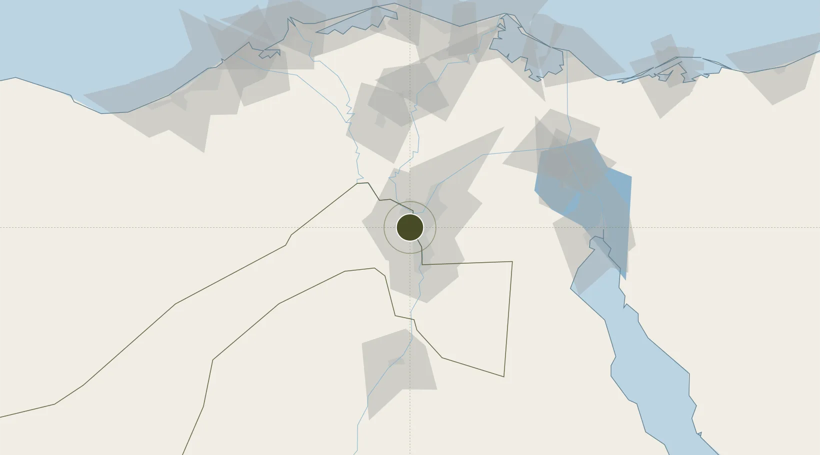
30.0231°, 31.2065°
2 ha
Zone area
118.1 km
Nearest port
16.6 km
Nearest airport

Gateway access

Nearest neighbours — logibook spatial index (haversine) over the source coordinates

Zone profile

Zone type
Economic Revitalization Project
Open Zone Map
Region
Al Jizah
Open Zone Map
Status
Active
Open Zone Map
Management
Public
Open Zone Map
Operator
General Authority for Investment & Free Zones
Open Zone Map
Legal framework
Law No. 83 on Special Economic Zones
Open Zone Map

Location

Location of ozm-1853
Natural Earth 10m (public domain) · Al Jizah · ozm-1853 · 30.02, 31.21GoogleOSMYandex

Nearby Logistics Neighbours

Ports
  1. 1Sokhna Port Gas Tanker Terminal118 km
  2. 2Ain Sukhna Terminal119 km
  3. 3El Ismailiya121 km
  4. 4El-Adabiya123 km
  5. 5As Suways130 km
Nearest neighbours — logibook spatial index (haversine) over the source coordinates
Airports
  1. 1Almaza Air Force Base17 km
  2. 2Cairo International Airport21 km
  3. 3Cairo West Air Base30 km
  4. 4Sphinx International Airport31 km
  5. 5Bilbeis Air Base56 km
Nearest neighbours — logibook spatial index (haversine) over the source coordinates
Cities
  1. 1Bahtim14 km
  2. 2Qalyub16 km
  3. 3Sixth of October City24 km
  4. 46th October32 km
  5. 5Al Minya33 km
Nearest neighbours — logibook spatial index (haversine) over the source coordinates
Trade Zones
  1. 1Nasr City Public Free Zone14 km
  2. 2City Center Almaza Investment Zone17 km
  3. 3Nasr Free Economic Zone17 km
  4. 4Media Public Free Zone20 km
  5. 5Arab Al Olayqat Investment Zone28 km
Nearest neighbours — logibook spatial index (haversine) over the source coordinates
DatabookThe Record of Consolidated Knowledge
Egypt beyond logistics?
Browse databook

All Sources

Trade ZonesOpen Zone Map
CC BY
Portsthe NGA World Port Index
Public domain (US gov)
AirportsOurAirports
Public domain
LocationsUN/LOCODE
UN/LOCODE — free
← Egypt trade zones