UN/LOCODE hub · Egypt
EGSOC

6th October

29.9144°, 30.9016°
2
Transport functions

Transport Functions

Road
Multimodal
UN/LOCODE

Hub Profile

Region
GZ
GeoNames
Logistics facilities
3
UN/LOCODE

Location

Location of EGSOC
Natural Earth 10m (public domain) · GZ · EGSOC · 29.91, 30.90GoogleOSMYandex

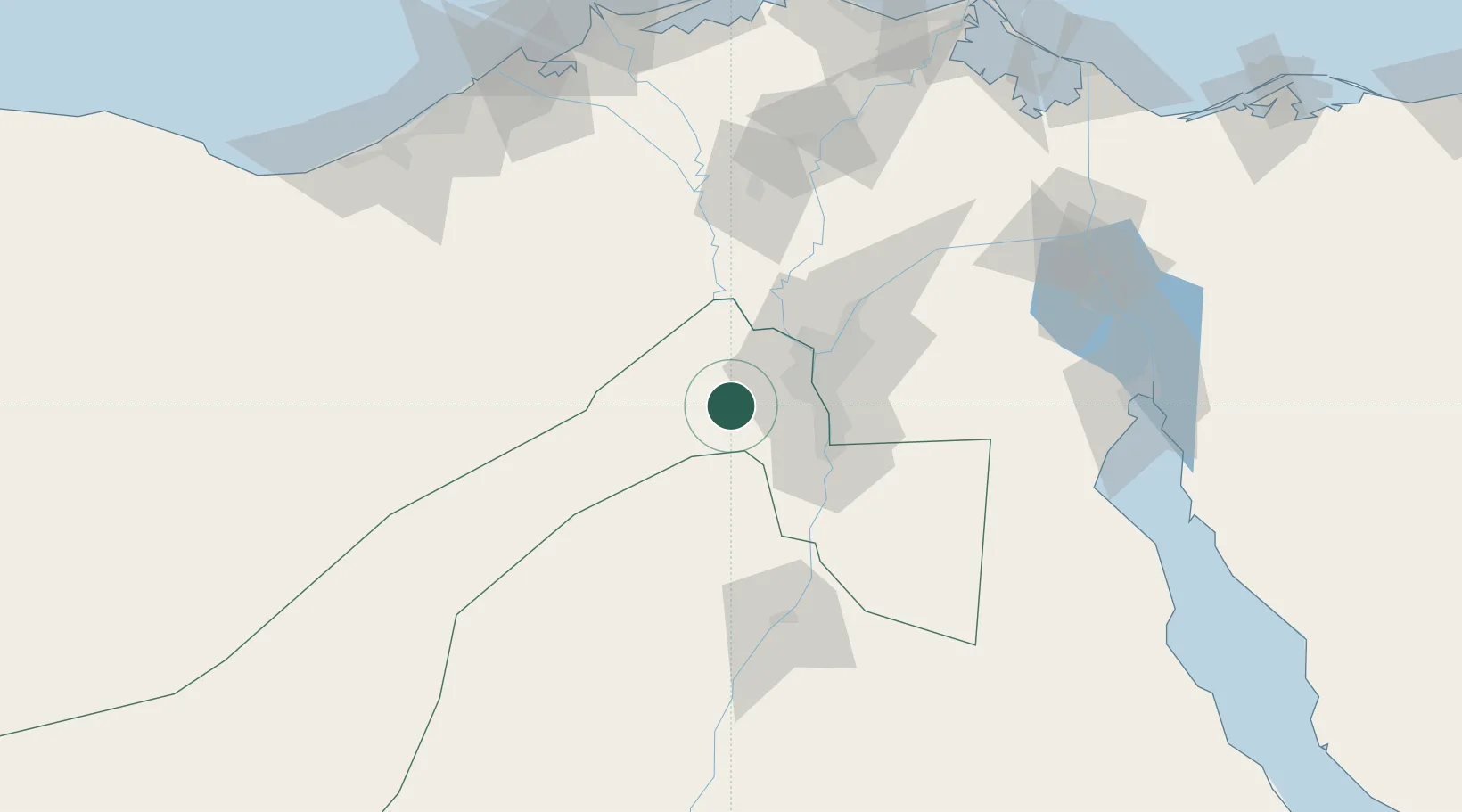
Nearby Logistics Neighbours

Cities
  1. 1Sixth of October City10 km
  2. 2October Dry Port25 km
  3. 3Qalyub40 km
  4. 4Al Minya42 km
  5. 5Bahtim43 km
Nearest neighbours — logibook spatial index (haversine) over the source coordinates
Ports
  1. 1Sokhna Port Gas Tanker Terminal144 km
  2. 2Ain Sukhna Terminal144 km
  3. 3El-Adabiya151 km
  4. 4El Ismailiya152 km
  5. 5As Suways159 km
Nearest neighbours — logibook spatial index (haversine) over the source coordinates
Airports
  1. 1Sphinx International Airport22 km
  2. 2Cairo West Air Base23 km
  3. 3Almaza Air Force Base48 km
  4. 4Cairo International Airport53 km
  5. 5Gebel El Basur Air Base77 km
Nearest neighbours — logibook spatial index (haversine) over the source coordinates
Trade Zones
  1. 1Media Public Free Zone12 km
  2. 2Cairo University Investment Zone32 km
  3. 3Nasr City Public Free Zone45 km
  4. 4City Center Almaza Investment Zone48 km
  5. 5Nasr Free Economic Zone49 km
Nearest neighbours — logibook spatial index (haversine) over the source coordinates
DatabookThe Record of Consolidated Knowledge
Egypt beyond logistics?
Browse databook

All Sources

LocationsUN/LOCODE
UN/LOCODE — free
Portsthe NGA World Port Index
Public domain (US gov)
AirportsOurAirports
Public domain
Trade Zonesthe World Bank SEZ database
CC BY 4.0
Trade ZonesOpen Zone Map
CC BY
← Egypt locations