UN/LOCODE hub · Egypt
EGXOO

Sixth of October City

29.9833°, 30.9667°
1
Transport functions

Transport Functions

Multimodal
UN/LOCODE

Hub Profile

Region
C
GeoNames

Location

Location of EGXOO
Natural Earth 10m (public domain) · C · EGXOO · 29.98, 30.97GoogleOSMYandex

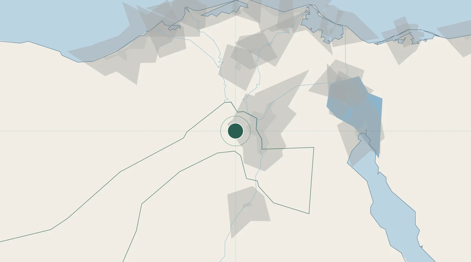
Nearby Logistics Neighbours

Cities
  1. 16th October10 km
  2. 2Qalyub30 km
  3. 3Bahtim33 km
  4. 4October Dry Port34 km
  5. 5Al Minya41 km
Nearest neighbours — logibook spatial index (haversine) over the source coordinates
Ports
  1. 1Sokhna Port Gas Tanker Terminal139 km
  2. 2Ain Sukhna Terminal140 km
  3. 3El Ismailiya143 km
  4. 4El-Adabiya145 km
  5. 5As Suways153 km
Nearest neighbours — logibook spatial index (haversine) over the source coordinates
Airports
  1. 1Sphinx International Airport16 km
  2. 2Cairo West Air Base16 km
  3. 3Almaza Air Force Base40 km
  4. 4Cairo International Airport44 km
  5. 5Quesna Airport68 km
Nearest neighbours — logibook spatial index (haversine) over the source coordinates
Trade Zones
  1. 1Media Public Free Zone5 km
  2. 2Cairo University Investment Zone24 km
  3. 3Nasr City Public Free Zone37 km
  4. 4City Center Almaza Investment Zone40 km
  5. 5Nasr Free Economic Zone41 km
Nearest neighbours — logibook spatial index (haversine) over the source coordinates
DatabookThe Record of Consolidated Knowledge
Egypt beyond logistics?
Browse databook

All Sources

LocationsUN/LOCODE
UN/LOCODE — free
Portsthe NGA World Port Index
Public domain (US gov)
AirportsOurAirports
Public domain
Trade Zonesthe World Bank SEZ database
CC BY 4.0
Trade ZonesOpen Zone Map
CC BY
← Egypt locations