UN/LOCODE hub · South Africa
ZAZBE

Denver

-26.2167°, 28.1000°
1
Transport functions

Transport Functions

Multimodal
UN/LOCODE

Hub Profile

Region
GT
GeoNames

Location

Location of ZAZBE
Natural Earth 10m (public domain) · GT · ZAZBE · -26.22, 28.10GoogleOSMYandex

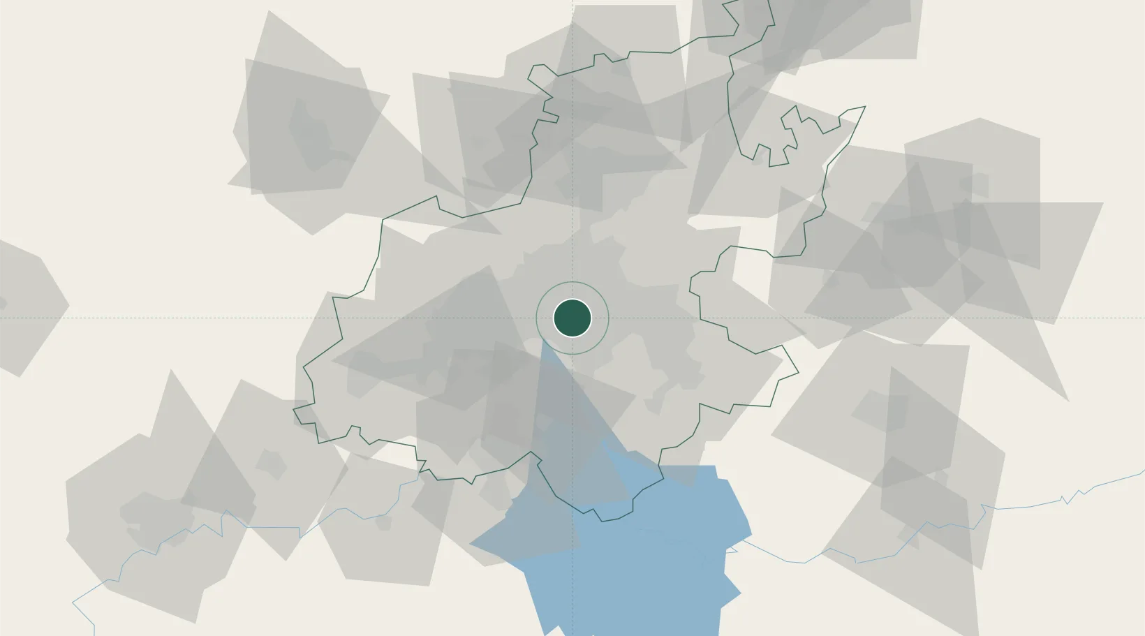
Nearby Logistics Neighbours

Cities
  1. 1Kensington2 km
  2. 2Heriotdale/Johannesburg3 km
  3. 3Kaserne3 km
  4. 4Benrose4 km
  5. 5Jeppestown4 km
Nearest neighbours — logibook spatial index (haversine) over the source coordinates
Ports
  1. 1Maputo445 km
  2. 2Richards Bay488 km
  3. 3Durban499 km
  4. 4East London758 km
  5. 5Inhambane778 km
Nearest neighbours — logibook spatial index (haversine) over the source coordinates
Airports
  1. 1Rand Airport6 km
  2. 2O.R. Tambo International Airport17 km
  3. 3Grand Central Airport26 km
  4. 4Lanseria International Airport35 km
  5. 5Vereeniging Airport41 km
Nearest neighbours — logibook spatial index (haversine) over the source coordinates
Trade Zones
  1. 1OR Tambo Industrial Development Zone19 km
  2. 2Tshwane Automotive Industrial Zone59 km
  3. 3Vaal Special Economic Zone60 km
  4. 4Babelegi Industrial Park98 km
  5. 5Bojanala (Platinum Valley) Special Economic Zone134 km
Nearest neighbours — logibook spatial index (haversine) over the source coordinates
DatabookThe Record of Consolidated Knowledge
South Africa beyond logistics?
Browse databook

All Sources

LocationsUN/LOCODE
UN/LOCODE — free
Portsthe NGA World Port Index
Public domain (US gov)
AirportsOurAirports
Public domain
Trade Zonesthe World Bank SEZ database
CC BY 4.0
Trade ZonesOpen Zone Map
CC BY
← South Africa locations