UN/LOCODE hub · Vietnam
VNVAG

Vung Áng

18.0667°, 106.4333°
1
Transport functions

Transport Functions

Port
UN/LOCODE

Location

Location of VNVAG
Natural Earth 10m (public domain) · Quảng Bình · VNVAG · 18.07, 106.43GoogleOSMYandex

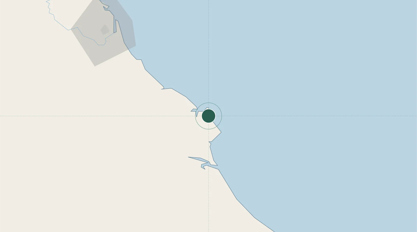
Nearby Logistics Neighbours

Cities
  1. 1Son Duong Port4 km
  2. 2Hon La Port17 km
  3. 3Dông Hài19 km
  4. 4Quäng Bình64 km
  5. 5Quang Ninh77 km
Nearest neighbours — logibook spatial index (haversine) over the source coordinates
Ports
  1. 1Nghe Tinh105 km
  2. 2Basuo257 km
  3. 3Da Nang289 km
  4. 4Hai Phong318 km
  5. 5Sanya320 km
Nearest neighbours — logibook spatial index (haversine) over the source coordinates
Airports
  1. 1Dong Hoi Airport64 km
  2. 2Vinh Airport110 km
  3. 3Nakhon Phanom Airport204 km
  4. 4Tho Xuan Airport228 km
  5. 5Phu Bai International Airport229 km
Nearest neighbours — logibook spatial index (haversine) over the source coordinates
Trade Zones
  1. 1Vung Ang Coastal Economic Zone3 km
  2. 2Vung Ang Economic Zone5 km
  3. 3Hòn La Coastal Economic Zone16 km
  4. 4Western Gateway Industrial Park22 km
  5. 5Bac Đồng Hới Industrial Zone62 km
Nearest neighbours — logibook spatial index (haversine) over the source coordinates
DatabookThe Record of Consolidated Knowledge
Vietnam beyond logistics?
Browse databook

All Sources

LocationsUN/LOCODE
UN/LOCODE — free
Portsthe NGA World Port Index
Public domain (US gov)
AirportsOurAirports
Public domain
Trade Zonesthe World Bank SEZ database
CC BY 4.0
Trade ZonesOpen Zone Map
CC BY
← Vietnam locations