UN/LOCODE hub · United States
USYVI

Vashon Island

47.4167°, -122.4667°
3
Transport functions

Transport Functions

Port
Road
Multimodal
UN/LOCODE

Hub Profile

Region
WA
GeoNames

Location

Location of USYVI
Natural Earth 10m (public domain) · WA · USYVI · 47.42, -122.47GoogleOSMYandex

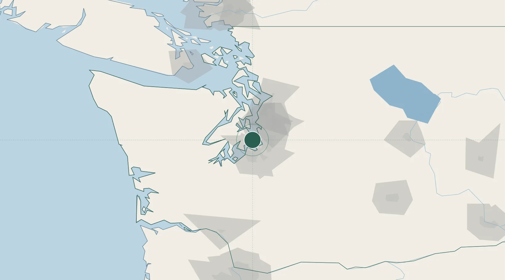
Nearby Logistics Neighbours

Cities
  1. 1Des Moines11 km
  2. 2Burien12 km
  3. 3Wauna14 km
  4. 4Manchester16 km
  5. 5Tacoma17 km
Nearest neighbours — logibook spatial index (haversine) over the source coordinates
Ports
  1. 1Tacoma15 km
  2. 2Port Orchard18 km
  3. 3Bremerton22 km
  4. 4Seattle23 km
  5. 5Silverdale31 km
Nearest neighbours — logibook spatial index (haversine) over the source coordinates
Airports
  1. 1Seattle–Tacoma International Airport12 km
  2. 2King County International Airport - Boeing Field18 km
  3. 3Tacoma Narrows Airport19 km
  4. 4Bremerton National Airport24 km
  5. 5Kenmore Air Harbor Seaplane Base26 km
Nearest neighbours — logibook spatial index (haversine) over the source coordinates
Trade Zones
  1. 1FTZ No. 086 Tacoma17 km
  2. 2FTZ No. 212 Tacoma19 km
  3. 3FTZ No. 005 Seattle22 km
  4. 4FTZ No. 216 Olympia55 km
  5. 5FTZ No. 085 Everett68 km
Nearest neighbours — logibook spatial index (haversine) over the source coordinates
DatabookThe Record of Consolidated Knowledge
United States beyond logistics?
Browse databook

All Sources

LocationsUN/LOCODE
UN/LOCODE — free
Portsthe NGA World Port Index
Public domain (US gov)
AirportsOurAirports
Public domain
Trade Zonesthe World Bank SEZ database
CC BY 4.0
Trade ZonesOpen Zone Map
CC BY
← United States locations