UN/LOCODE hub · United States
USYLE

Fort Lewis

47.0500°, -122.5667°
2
Transport functions

Transport Functions

Road
Multimodal
UN/LOCODE

Hub Profile

Place type
Populated place
GeoNames
Region
Virginia
GeoNames
Time zone
America/New_York
GeoNames
Elevation
501 m
GeoNames

Location

Location of USYLE
Natural Earth 10m (public domain) · Virginia · USYLE · 47.05, -122.57GoogleOSMYandex

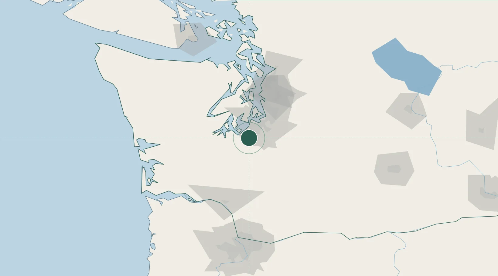
Nearby Logistics Neighbours

Cities
  1. 1McChord Air Force Base11 km
  2. 2Yelm13 km
  3. 3Olympia26 km
  4. 4Fife26 km
  5. 5Tacoma29 km
Nearest neighbours — logibook spatial index (haversine) over the source coordinates
Ports
  1. 1Olympia25 km
  2. 2Tacoma28 km
  3. 3Shelton44 km
  4. 4Port Orchard54 km
  5. 5Bremerton58 km
Nearest neighbours — logibook spatial index (haversine) over the source coordinates
Airports
  1. 1Gray Army Air Field3 km
  2. 2McChord Air Force Base12 km
  3. 3Tacoma Narrows Airport24 km
  4. 4Olympia Regional Airport27 km
  5. 5Seattle–Tacoma International Airport48 km
Nearest neighbours — logibook spatial index (haversine) over the source coordinates
Trade Zones
  1. 1FTZ No. 212 Tacoma22 km
  2. 2FTZ No. 086 Tacoma27 km
  3. 3FTZ No. 216 Olympia28 km
  4. 4FTZ No. 005 Seattle63 km
  5. 5FTZ No. 120 Cowlitz County109 km
Nearest neighbours — logibook spatial index (haversine) over the source coordinates
DatabookThe Record of Consolidated Knowledge
United States beyond logistics?
Browse databook

All Sources

LocationsUN/LOCODE
UN/LOCODE — free
Portsthe NGA World Port Index
Public domain (US gov)
AirportsOurAirports
Public domain
Trade Zonesthe World Bank SEZ database
CC BY 4.0
Trade ZonesOpen Zone Map
CC BY
← United States locations