UN/LOCODE hub · United States
USWD3

Weed

41.4333°, -122.3833°
2,556
Population
3
Transport functions

Transport Functions

Rail
Road
Multimodal
UN/LOCODE

Hub Profile

Place type
Populated place
GeoNames
Region
California
GeoNames
Population
2,556
GeoNames
Time zone
America/Los_Angeles
GeoNames
Elevation
1,044 m
GeoNames

Location

Location of USWD3
Natural Earth 10m (public domain) · California · USWD3 · 41.43, -122.38GoogleOSMYandex

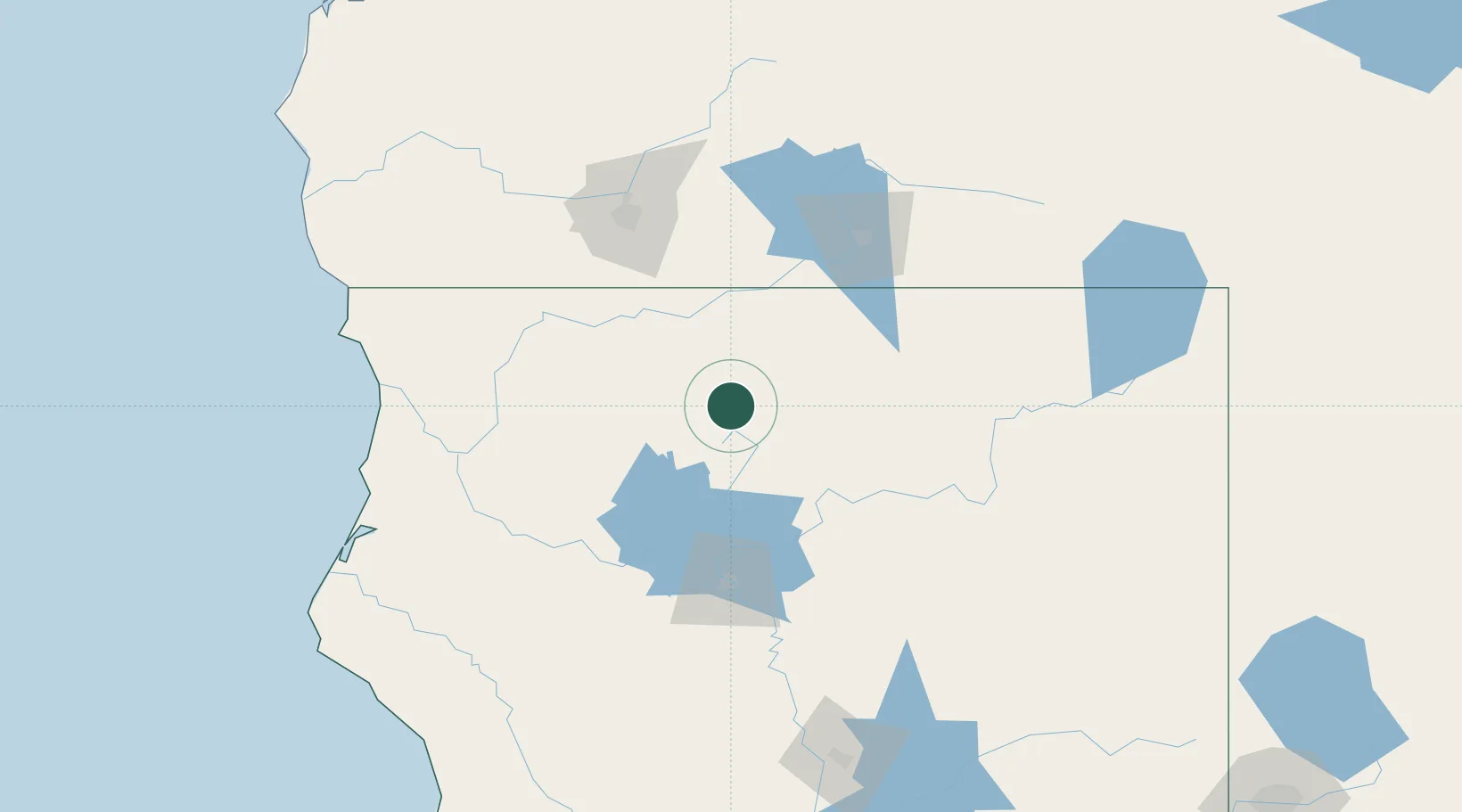
Nearby Logistics Neighbours

Cities
  1. 1Lakeshore61 km
  2. 2Mammoth92 km
  3. 3Talent95 km
  4. 4Phoenix101 km
  5. 5Jacksonville107 km
Nearest neighbours — logibook spatial index (haversine) over the source coordinates
Ports
  1. 1Crescent City155 km
  2. 2Samoa166 km
  3. 3Eureka166 km
  4. 4Fields Landing173 km
  5. 5Port Orford227 km
Nearest neighbours — logibook spatial index (haversine) over the source coordinates
Airports
  1. 1Crater Lake-Klamath Regional Airport97 km
  2. 2Redding Municipal Airport103 km
  3. 3Rogue Valley International-Medford Airport112 km
  4. 4Red Bluff Municipal Airport143 km
  5. 5California Redwood Coast-Humboldt County Airport153 km
Nearest neighbours — logibook spatial index (haversine) over the source coordinates
Trade Zones
  1. 1FTZ No. 248 Eureka165 km
  2. 2FTZ No. 132 Coos County263 km
  3. 3FTZ No. 126 Sparks302 km
  4. 4FTZ No. 143 West Sacramento325 km
  5. 5FTZ No. 231 Stockton398 km
Nearest neighbours — logibook spatial index (haversine) over the source coordinates
DatabookThe Record of Consolidated Knowledge
United States beyond logistics?
Browse databook

All Sources

LocationsUN/LOCODE
UN/LOCODE — free
LocationsGeoNames
CC BY 4.0
Portsthe NGA World Port Index
Public domain (US gov)
AirportsOurAirports
Public domain
Trade Zonesthe World Bank SEZ database
CC BY 4.0
Trade ZonesOpen Zone Map
CC BY
← United States locations