UN/LOCODE hub · United States
USREG

Marengo

42.2463°, -88.5899°
7,503
Population
3
Transport functions

Transport Functions

Rail
Road
Multimodal
UN/LOCODE

Hub Profile

Place type
Populated place
GeoNames
Region
Illinois
GeoNames
Population
7,503
GeoNames
Time zone
America/Chicago
GeoNames
Elevation
254 m
GeoNames
Logistics facilities
2
UN/LOCODE

Location

Location of USREG
Natural Earth 10m (public domain) · Illinois · USREG · 42.25, -88.59GoogleOSMYandex

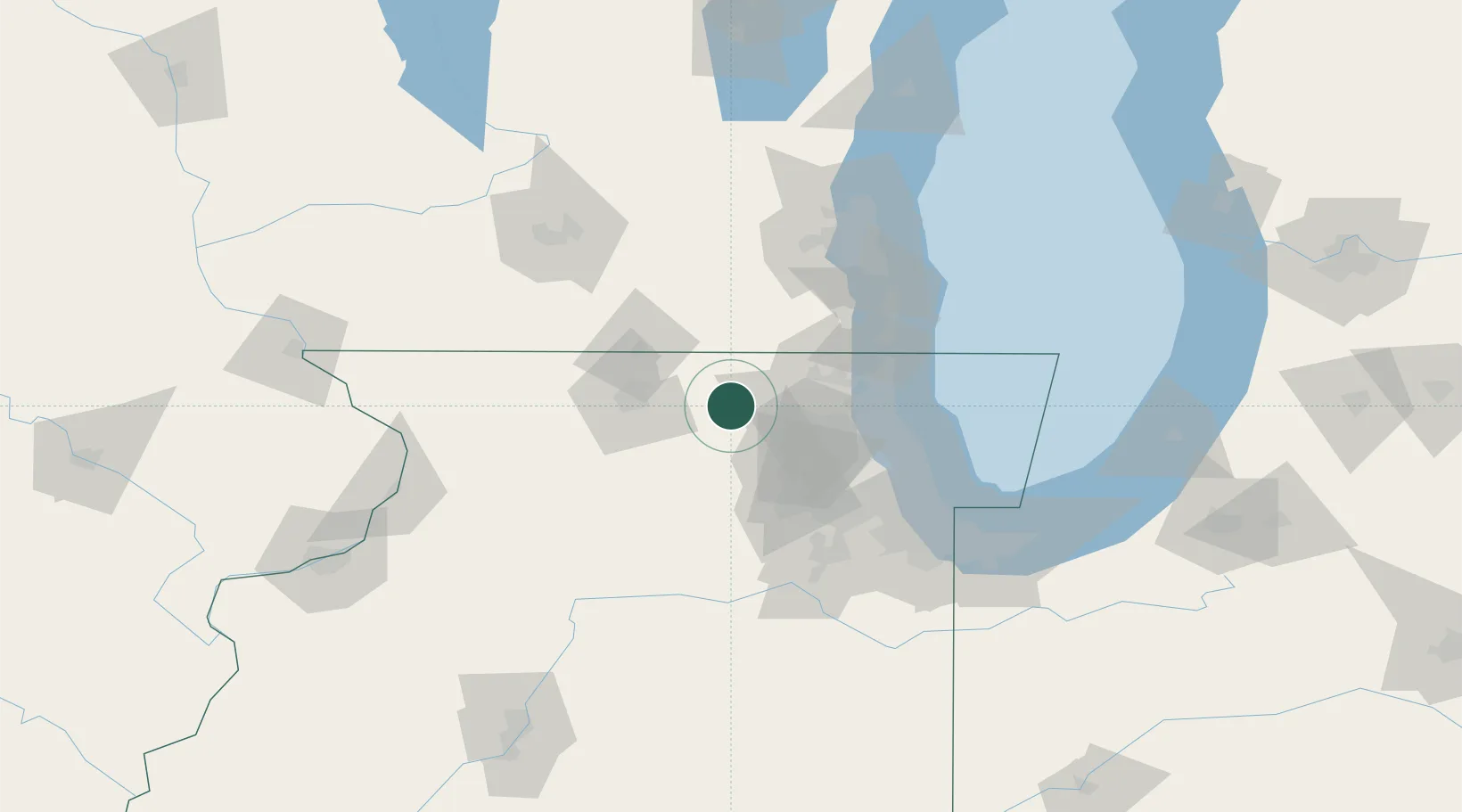
Nearby Logistics Neighbours

Cities
  1. 1Capron19 km
  2. 2Greenwood23 km
  3. 3Gilberts25 km
  4. 4Algonquin26 km
  5. 5Kirkland27 km
Nearest neighbours — logibook spatial index (haversine) over the source coordinates
Ports
  1. 1Great Lakes63 km
  2. 2Waukegan65 km
  3. 3Kenosha74 km
  4. 4Wilmette77 km
  5. 5Racine86 km
Nearest neighbours — logibook spatial index (haversine) over the source coordinates
Airports
  1. 1Chicago Rockford International Airport42 km
  2. 2Dupage Airport47 km
  3. 3Chicago Executive Airport59 km
  4. 4Chicago O'Hare International Airport64 km
  5. 5Kenosha Regional Airport67 km
Nearest neighbours — logibook spatial index (haversine) over the source coordinates
Trade Zones
  1. 1FTZ No. 176 Rockford51 km
  2. 2FTZ No. 292 Lake County58 km
  3. 3FTZ No. 022 Chicago75 km
  4. 4FTZ No. 041 Milwaukee99 km
  5. 5FTZ No. 266 Dane County129 km
Nearest neighbours — logibook spatial index (haversine) over the source coordinates
DatabookThe Record of Consolidated Knowledge
United States beyond logistics?
Browse databook

All Sources

LocationsUN/LOCODE
UN/LOCODE — free
LocationsGeoNames
CC BY 4.0
Portsthe NGA World Port Index
Public domain (US gov)
AirportsOurAirports
Public domain
Trade Zonesthe World Bank SEZ database
CC BY 4.0
Trade ZonesOpen Zone Map
CC BY
← United States locations