UN/LOCODE hub · United States
USQUC

Cactus (Moore County)

36.0500°, -101.9167°
2
Transport functions

Transport Functions

Road
Multimodal
UN/LOCODE

Hub Profile

Region
TX
GeoNames

Location

Location of USQUC
Natural Earth 10m (public domain) · TX · USQUC · 36.05, -101.92GoogleOSMYandex

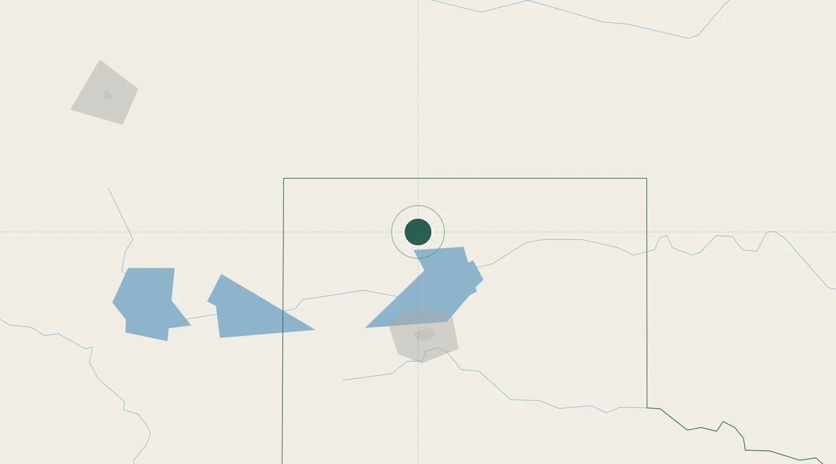
Nearby Logistics Neighbours

Cities
  1. 1Etter7 km
  2. 2Sunray10 km
  3. 3Borger64 km
  4. 4Panhandle, Carson92 km
  5. 5Felt97 km
Nearest neighbours — logibook spatial index (haversine) over the source coordinates
Ports
  1. 1Deer Park931 km
  2. 2Houston935 km
  3. 3Pasadena942 km
  4. 4Baytown953 km
  5. 5Port Lavaca965 km
Nearest neighbours — logibook spatial index (haversine) over the source coordinates
Airports
  1. 1Dalhart Municipal Airport57 km
  2. 2Guymon Municipal Airport80 km
  3. 3Rick Husband Amarillo International Airport95 km
  4. 4Liberal Mid-America Regional Airport140 km
  5. 5Tucumcari Municipal Airport180 km
Nearest neighbours — logibook spatial index (haversine) over the source coordinates
Trade Zones
  1. 1FTZ No. 252 Amarillo94 km
  2. 2FTZ No. 260 Lubbock274 km
  3. 3FTZ No. 261 Alexandria274 km
  4. 4FTZ No. 293 Limon390 km
  5. 5FTZ No. 106 Oklahoma City402 km
Nearest neighbours — logibook spatial index (haversine) over the source coordinates
DatabookThe Record of Consolidated Knowledge
United States beyond logistics?
Browse databook

All Sources

LocationsUN/LOCODE
UN/LOCODE — free
Portsthe NGA World Port Index
Public domain (US gov)
AirportsOurAirports
Public domain
Trade Zonesthe World Bank SEZ database
CC BY 4.0
Trade ZonesOpen Zone Map
CC BY
← United States locations