UN/LOCODE hub · United States
USOZE

Ocoee, Polk

35.1333°, -84.7167°
2
Transport functions

Transport Functions

Rail
Road
UN/LOCODE

Hub Profile

Region
TN
GeoNames

Location

Location of USOZE
Natural Earth 10m (public domain) · TN · USOZE · 35.13, -84.72GoogleOSMYandex

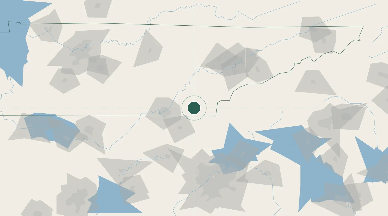
Nearby Logistics Neighbours

Cities
  1. 1Ocoee2 km
  2. 2Cleveland12 km
  3. 3Calhoun19 km
  4. 4Delano21 km
  5. 5Eton24 km
Nearest neighbours — logibook spatial index (haversine) over the source coordinates
Ports
  1. 1Savannah478 km
  2. 2Beaufort480 km
  3. 3Port Royal483 km
  4. 4Darien518 km
  5. 5Brunswick535 km
Nearest neighbours — logibook spatial index (haversine) over the source coordinates
Airports
  1. 1Chattanooga Metropolitan Airport (Lovell Field)46 km
  2. 2Western Carolina Regional Airport78 km
  3. 3Richard B Russell Airport96 km
  4. 4Crossville Memorial Airport Whitson Field97 km
  5. 5McGhee Tyson Airport100 km
Nearest neighbours — logibook spatial index (haversine) over the source coordinates
Trade Zones
  1. 1FTZ No. 134 Chattanooga60 km
  2. 2FTZ No. 148 Knoxville105 km
  3. 3FTZ No. 026 Atlanta155 km
  4. 4FTZ No. 083 Huntsville195 km
  5. 5FTZ No. 270 Lawrence County208 km
Nearest neighbours — logibook spatial index (haversine) over the source coordinates
DatabookThe Record of Consolidated Knowledge
United States beyond logistics?
Browse databook

All Sources

LocationsUN/LOCODE
UN/LOCODE — free
Portsthe NGA World Port Index
Public domain (US gov)
AirportsOurAirports
Public domain
Trade Zonesthe World Bank SEZ database
CC BY 4.0
Trade ZonesOpen Zone Map
CC BY
← United States locations