UN/LOCODE hub · United States
USOFN

Crofton

37.0333°, -87.4833°
754
Population
2
Transport functions

Transport Functions

Road
Multimodal
UN/LOCODE

Hub Profile

Place type
Populated place
GeoNames
Region
Kentucky
GeoNames
Population
754
GeoNames
Time zone
America/Chicago
GeoNames
Elevation
182 m
GeoNames

Location

Location of USOFN
Natural Earth 10m (public domain) · Kentucky · USOFN · 37.03, -87.48GoogleOSMYandex

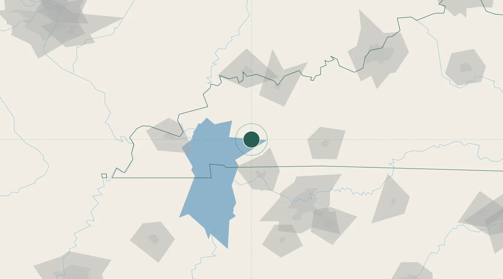
Nearby Logistics Neighbours

Cities
  1. 1Mortons Gap22 km
  2. 2Earlington26 km
  3. 3Cadiz35 km
  4. 4Elkton39 km
  5. 5Hanson43 km
Nearest neighbours — logibook spatial index (haversine) over the source coordinates
Ports
  1. 1Port Of Memphis326 km
  2. 2Gary510 km
  3. 3Indiana Harbor515 km
  4. 4Calumet Harbor523 km
  5. 5Michigan City525 km
Nearest neighbours — logibook spatial index (haversine) over the source coordinates
Airports
  1. 1Campbell Army Airfield (Fort Campbell)40 km
  2. 2Owensboro Daviess County Airport83 km
  3. 3Bowling Green Warren County Regional Airport95 km
  4. 4Evansville Regional Airport112 km
  5. 5Barkley Regional Airport115 km
Nearest neighbours — logibook spatial index (haversine) over the source coordinates
Trade Zones
  1. 1FTZ No. 294 Western Kentucky98 km
  2. 2FTZ No. 078 Nashville101 km
  3. 3FTZ No. 177 Evansville108 km
  4. 4FTZ No. 029 Louisville202 km
  5. 5FTZ No. 283 West Tennessee243 km
Nearest neighbours — logibook spatial index (haversine) over the source coordinates
DatabookThe Record of Consolidated Knowledge
United States beyond logistics?
Browse databook

All Sources

LocationsUN/LOCODE
UN/LOCODE — free
LocationsGeoNames
CC BY 4.0
Portsthe NGA World Port Index
Public domain (US gov)
AirportsOurAirports
Public domain
Trade Zonesthe World Bank SEZ database
CC BY 4.0
Trade ZonesOpen Zone Map
CC BY
← United States locations