UN/LOCODE hub · United States
USNEI

Newfields

43.0333°, -70.9333°
301
Population
3
Transport functions

Transport Functions

Rail
Road
Multimodal
UN/LOCODE

Hub Profile

Place type
Populated place
GeoNames
Region
New Hampshire
GeoNames
Population
301
GeoNames
Time zone
America/New_York
GeoNames
Elevation
21 m
GeoNames

Location

Location of USNEI
Natural Earth 10m (public domain) · New Hampshire · USNEI · 43.03, -70.93GoogleOSMYandex

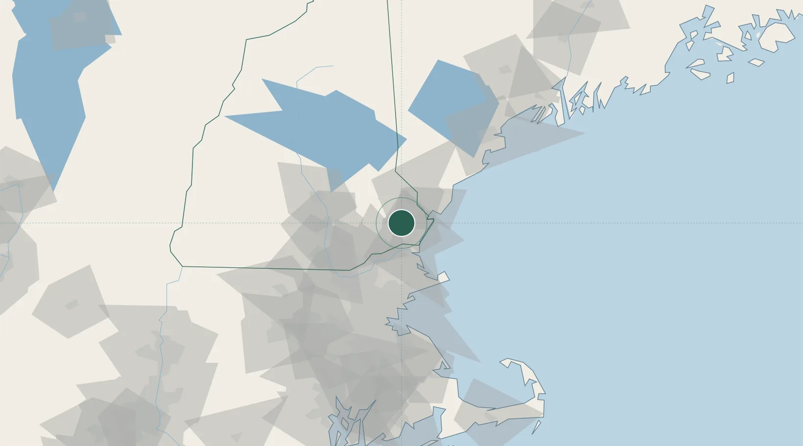
Nearby Logistics Neighbours

Cities
  1. 1North Hampton11 km
  2. 2Durham11 km
  3. 3Newington12 km
  4. 4Kittery17 km
  5. 5South Hampton19 km
Nearest neighbours — logibook spatial index (haversine) over the source coordinates
Ports
  1. 1Portsmouth16 km
  2. 2Newburyport25 km
  3. 3Rockport48 km
  4. 4Kennebunkport53 km
  5. 5Beverly56 km
Nearest neighbours — logibook spatial index (haversine) over the source coordinates
Airports
  1. 1Portsmouth International Airport at Pease10 km
  2. 2Lawrence Municipal Airport38 km
  3. 3Manchester-Boston Regional Airport42 km
  4. 4Concord Municipal Airport50 km
  5. 5Beverly Regional Airport50 km
Nearest neighbours — logibook spatial index (haversine) over the source coordinates
Trade Zones
  1. 1FTZ No. 081 Portsmouth8 km
  2. 2FTZ No. 027 Boston81 km
  3. 3FTZ No. 263 Auburn132 km
  4. 4FTZ No. 268 Brattleboro137 km
  5. 5FTZ No. 105 Providence and North Kingstown142 km
Nearest neighbours — logibook spatial index (haversine) over the source coordinates
DatabookThe Record of Consolidated Knowledge
United States beyond logistics?
Browse databook

All Sources

LocationsUN/LOCODE
UN/LOCODE — free
LocationsGeoNames
CC BY 4.0
Portsthe NGA World Port Index
Public domain (US gov)
AirportsOurAirports
Public domain
Trade Zonesthe World Bank SEZ database
CC BY 4.0
Trade ZonesOpen Zone Map
CC BY
← United States locations