UN/LOCODE hub · United States
USGUL

Guilford

45.1667°, -69.3833°
903
Population
3
Transport functions

Transport Functions

Rail
Road
Multimodal
UN/LOCODE

Hub Profile

Place type
Populated place
GeoNames
Region
Maine
GeoNames
Population
903
GeoNames
Time zone
America/New_York
GeoNames
Elevation
115 m
GeoNames

Location

Location of USGUL
Natural Earth 10m (public domain) · Maine · USGUL · 45.17, -69.38GoogleOSMYandex

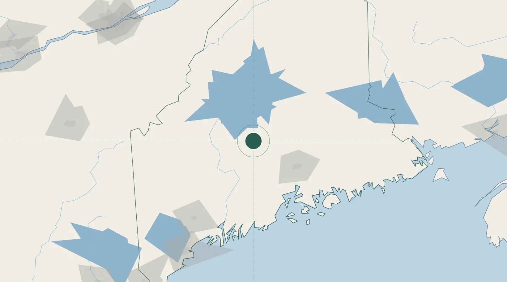
Nearby Logistics Neighbours

Cities
  1. 1Corinth37 km
  2. 2Newport38 km
  3. 3Bingham41 km
  4. 4Pittsfield43 km
  5. 5Burnham54 km
Nearest neighbours — logibook spatial index (haversine) over the source coordinates
Ports
  1. 1Bangor63 km
  2. 2Winterport73 km
  3. 3Bucksport82 km
  4. 4Sandypoint85 km
  5. 5Searsport88 km
Nearest neighbours — logibook spatial index (haversine) over the source coordinates
Airports
  1. 1Bangor International Airport59 km
  2. 2Augusta State Airport100 km
  3. 3Islesboro Airport103 km
  4. 4Hancock County-Bar Harbor Airport113 km
  5. 5Witherspoons Airport120 km
Nearest neighbours — logibook spatial index (haversine) over the source coordinates
Trade Zones
  1. 1FTZ No. 058 Bangor60 km
  2. 2FTZ No. 186 Waterville74 km
  3. 3FTZ No. 263 Auburn136 km
  4. 4Québec City FTZ235 km
  5. 5FTZ No. 179 Madawaska248 km
Nearest neighbours — logibook spatial index (haversine) over the source coordinates
DatabookThe Record of Consolidated Knowledge
United States beyond logistics?
Browse databook

All Sources

LocationsUN/LOCODE
UN/LOCODE — free
LocationsGeoNames
CC BY 4.0
Portsthe NGA World Port Index
Public domain (US gov)
AirportsOurAirports
Public domain
Trade Zonesthe World Bank SEZ database
CC BY 4.0
Trade ZonesOpen Zone Map
CC BY
← United States locations