UN/LOCODE hub · United States
USFGD

Fredonia

37.2000°, -88.0500°
393
Population
2
Transport functions

Transport Functions

Rail
Road
UN/LOCODE

Hub Profile

Place type
Populated place
GeoNames
Region
Kentucky
GeoNames
Population
393
GeoNames
Time zone
America/Chicago
GeoNames
Elevation
130 m
GeoNames

Location

Location of USFGD
Natural Earth 10m (public domain) · Kentucky · USFGD · 37.20, -88.05GoogleOSMYandex

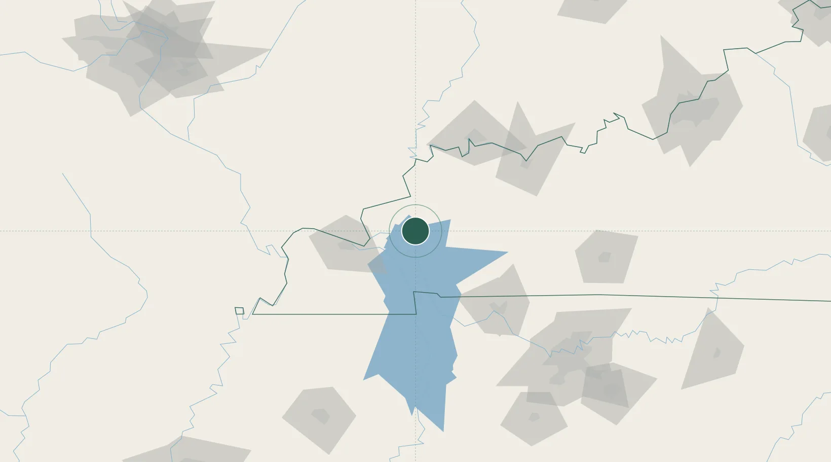
Nearby Logistics Neighbours

Cities
  1. 1Eddyville13 km
  2. 2Calvert City32 km
  3. 3Providence, Webster34 km
  4. 4Rosiclare36 km
  5. 5Sturgis38 km
Nearest neighbours — logibook spatial index (haversine) over the source coordinates
Ports
  1. 1Port Of Memphis304 km
  2. 2Gary495 km
  3. 3Indiana Harbor500 km
  4. 4Calumet Harbor506 km
  5. 5Michigan City514 km
Nearest neighbours — logibook spatial index (haversine) over the source coordinates
Airports
  1. 1Barkley Regional Airport66 km
  2. 2Campbell Army Airfield (Fort Campbell)77 km
  3. 3Owensboro Daviess County Airport98 km
  4. 4Evansville Regional Airport104 km
  5. 5Veterans Airport of Southern Illinois105 km
Nearest neighbours — logibook spatial index (haversine) over the source coordinates
Trade Zones
  1. 1FTZ No. 294 Western Kentucky49 km
  2. 2FTZ No. 177 Evansville97 km
  3. 3FTZ No. 078 Nashville143 km
  4. 4FTZ No. 283 West Tennessee217 km
  5. 5FTZ No. 031 Granite City255 km
Nearest neighbours — logibook spatial index (haversine) over the source coordinates
DatabookThe Record of Consolidated Knowledge
United States beyond logistics?
Browse databook

All Sources

LocationsUN/LOCODE
UN/LOCODE — free
LocationsGeoNames
CC BY 4.0
Portsthe NGA World Port Index
Public domain (US gov)
AirportsOurAirports
Public domain
Trade Zonesthe World Bank SEZ database
CC BY 4.0
Trade ZonesOpen Zone Map
CC BY
← United States locations