UN/LOCODE hub · United States
USCXZ

Sharon Center

41.1000°, -81.7333°
2
Transport functions

Transport Functions

Rail
Road
UN/LOCODE

Hub Profile

Place type
Populated place
GeoNames
Region
Ohio
GeoNames
Time zone
America/New_York
GeoNames
Elevation
343 m
GeoNames

Location

Location of USCXZ
Natural Earth 10m (public domain) · Ohio · USCXZ · 41.10, -81.73GoogleOSMYandex

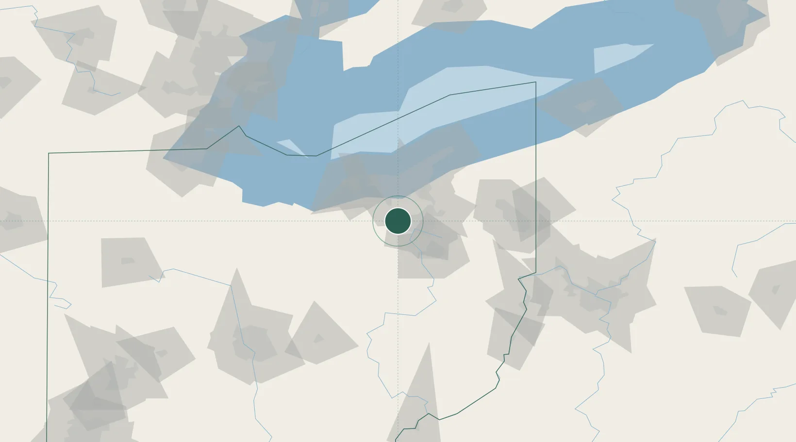
Nearby Logistics Neighbours

Cities
  1. 1Wadsworth9 km
  2. 2Fairlawn11 km
  3. 3Creston18 km
  4. 4Peninsula21 km
  5. 5Lodi22 km
Nearest neighbours — logibook spatial index (haversine) over the source coordinates
Ports
  1. 1Cleveland45 km
  2. 2Lorain56 km
  3. 3Vermilion65 km
  4. 4Huron76 km
  5. 5Fairport83 km
Nearest neighbours — logibook spatial index (haversine) over the source coordinates
Airports
  1. 1Akron Fulton International Airport23 km
  2. 2Akron Canton Regional Airport32 km
  3. 3Cleveland Hopkins International Airport36 km
  4. 4Burke Lakefront Airport47 km
  5. 5Cuyahoga County Airport56 km
Nearest neighbours — logibook spatial index (haversine) over the source coordinates
Trade Zones
  1. 1FTZ No. 181 Akron Canton16 km
  2. 2FTZ No. 040 Cleveland45 km
  3. 3FTZ No. 033 Pittsburgh160 km
  4. 4FTZ No. 008 Toledo162 km
  5. 5FTZ No. 151 Findlay165 km
Nearest neighbours — logibook spatial index (haversine) over the source coordinates
DatabookThe Record of Consolidated Knowledge
United States beyond logistics?
Browse databook

All Sources

LocationsUN/LOCODE
UN/LOCODE — free
Portsthe NGA World Port Index
Public domain (US gov)
AirportsOurAirports
Public domain
Trade Zonesthe World Bank SEZ database
CC BY 4.0
Trade ZonesOpen Zone Map
CC BY
← United States locations