UN/LOCODE hub · United States
USAB9

Auburn

43.0000°, -71.3500°
5,089
Population
2
Transport functions

Transport Functions

Road
Multimodal
UN/LOCODE

Hub Profile

Place type
Populated place
GeoNames
Region
New Hampshire
GeoNames
Population
5,089
GeoNames
Time zone
America/New_York
GeoNames
Elevation
78 m
GeoNames

Location

Location of USAB9
Natural Earth 10m (public domain) · New Hampshire · USAB9 · 43.00, -71.35GoogleOSMYandex

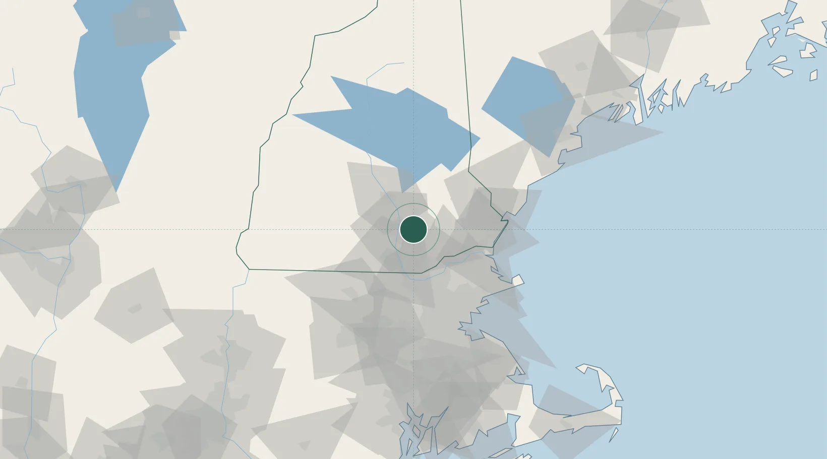
Nearby Logistics Neighbours

Cities
  1. 1New Londonderry10 km
  2. 2Raymond14 km
  3. 3Hooksett15 km
  4. 4Allenstown17 km
  5. 5Pembroke17 km
Nearest neighbours — logibook spatial index (haversine) over the source coordinates
Ports
  1. 1Newburyport44 km
  2. 2Portsmouth50 km
  3. 3Beverly64 km
  4. 4Salem66 km
  5. 5Marblehead69 km
Nearest neighbours — logibook spatial index (haversine) over the source coordinates
Airports
  1. 1Manchester-Boston Regional Airport10 km
  2. 2Concord Municipal Airport26 km
  3. 3Lawrence Municipal Airport37 km
  4. 4Portsmouth International Airport at Pease44 km
  5. 5Beverly Regional Airport58 km
Nearest neighbours — logibook spatial index (haversine) over the source coordinates
Trade Zones
  1. 1FTZ No. 081 Portsmouth42 km
  2. 2FTZ No. 027 Boston79 km
  3. 3FTZ No. 268 Brattleboro103 km
  4. 4FTZ No. 105 Providence and North Kingstown132 km
  5. 5FTZ No. 201 Holyoke141 km
Nearest neighbours — logibook spatial index (haversine) over the source coordinates
DatabookThe Record of Consolidated Knowledge
United States beyond logistics?
Browse databook

All Sources

LocationsUN/LOCODE
UN/LOCODE — free
LocationsGeoNames
CC BY 4.0
Portsthe NGA World Port Index
Public domain (US gov)
AirportsOurAirports
Public domain
Trade Zonesthe World Bank SEZ database
CC BY 4.0
Trade ZonesOpen Zone Map
CC BY
← United States locations