UN/LOCODE hub · El Salvador
SVEZB

Cutuco

13.3167°, -87.8167°
1
Transport functions

Transport Functions

Multimodal
UN/LOCODE

Location

Location of SVEZB
Natural Earth 10m (public domain) · La Unión · SVEZB · 13.32, -87.82GoogleOSMYandex

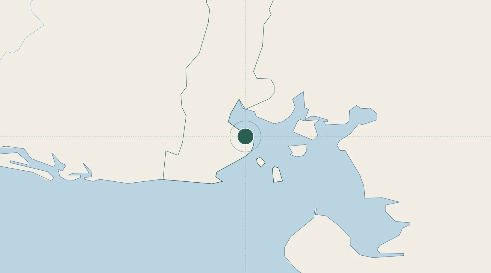
Nearby Logistics Neighbours

Cities
  1. 1La Union2 km
  2. 2San Lorenzo43 km
  3. 3Potosí49 km
  4. 4Monjarás50 km
  5. 5Chinameca61 km
Nearest neighbours — logibook spatial index (haversine) over the source coordinates
Ports
  1. 1La Union3 km
  2. 2Puerto De Hencan41 km
  3. 3Corinto116 km
  4. 4Puerto Sandino170 km
  5. 5Acajutla224 km
Nearest neighbours — logibook spatial index (haversine) over the source coordinates
Trade Zones
  1. 1Agroindustrias Chinandega, SA107 km
  2. 2ZIP Amaratecas Free Zone110 km
  3. 3ZEDE Orquídea112 km
  4. 4Camarones de Nicaragua, SA121 km
  5. 5Arnecom Nicaragua Operadora de Zonas Francas, SA142 km
Nearest neighbours — logibook spatial index (haversine) over the source coordinates
DatabookThe Record of Consolidated Knowledge
El Salvador beyond logistics?
Browse databook

All Sources

LocationsUN/LOCODE
UN/LOCODE — free
Portsthe NGA World Port Index
Public domain (US gov)
AirportsOurAirports
Public domain
Trade Zonesthe World Bank SEZ database
CC BY 4.0
Trade ZonesOpen Zone Map
CC BY
← El Salvador locations