UN/LOCODE hub · Panama
PAELA

El Alto

8.5167°, -81.0500°
85
Population
1
Transport functions

Transport Functions

Multimodal
UN/LOCODE

Hub Profile

Place type
District seat
GeoNames
Region
Veraguas Province
GeoNames
Population
85
GeoNames
Time zone
America/Panama
GeoNames
Elevation
621 m
GeoNames

Location

Location of PAELA
Natural Earth 10m (public domain) · Veraguas Province · PAELA · 8.52, -81.05GoogleOSMYandex

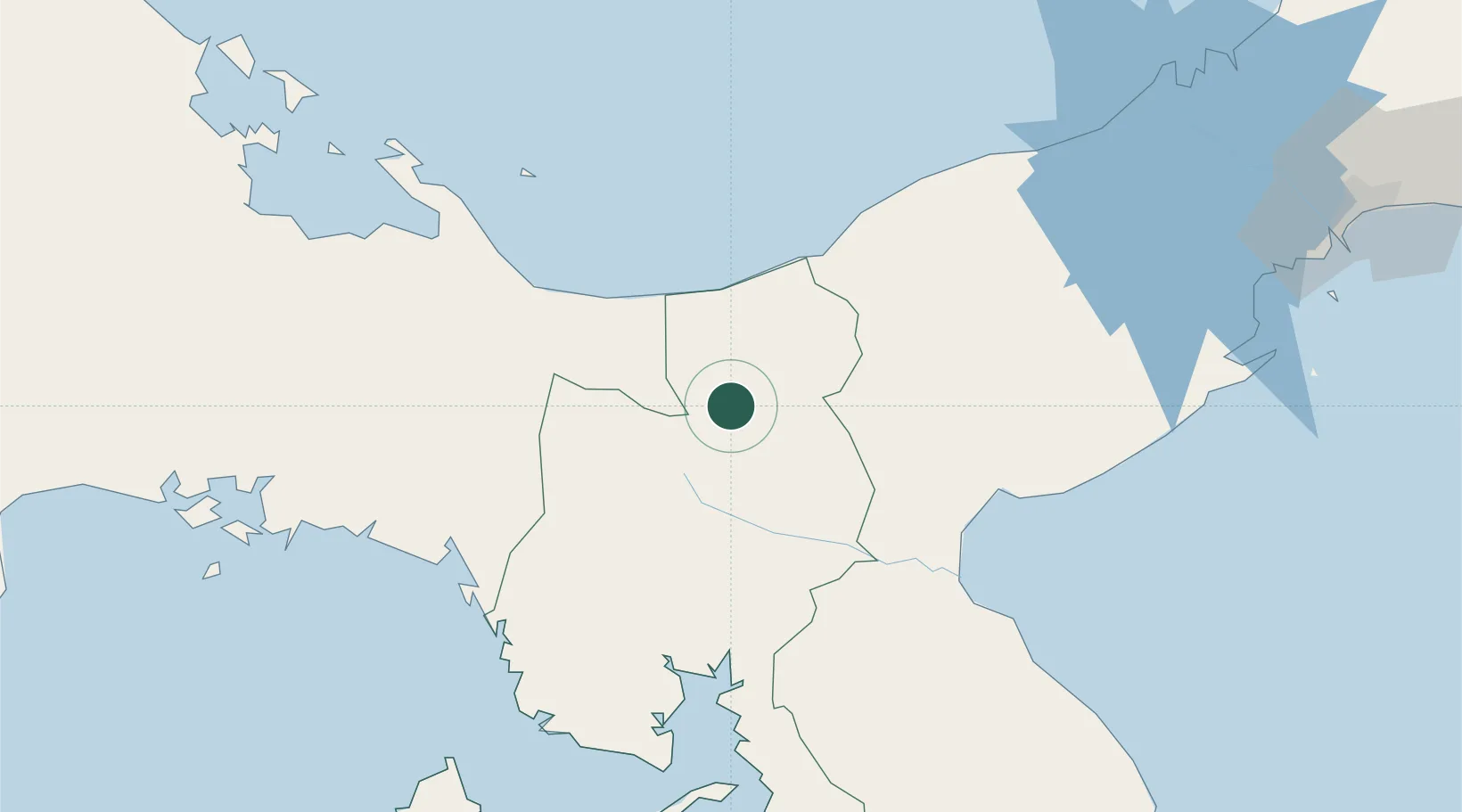
Nearby Logistics Neighbours

Cities
  1. 1Cañazas57 km
  2. 2Río Grande63 km
  3. 3El Rincon64 km
  4. 4Potuga69 km
  5. 5Pesé84 km
Nearest neighbours — logibook spatial index (haversine) over the source coordinates
Ports
  1. 1Punta Rincon68 km
  2. 2Chiriqui Grande127 km
  3. 3Pedregal153 km
  4. 4Puerto Cristobal155 km
  5. 5Vacamonte157 km
Nearest neighbours — logibook spatial index (haversine) over the source coordinates
Airports
  1. 1Ruben Cantu Airport49 km
  2. 2Alonso Valderrama Airport92 km
  3. 3Pixvae Airstrip94 km
  4. 4Scarlett Martinez International Airport103 km
  5. 5Enrique Malek International Airport153 km
Nearest neighbours — logibook spatial index (haversine) over the source coordinates
Trade Zones
  1. 1Zona Franca Cobol Due89 km
  2. 2Colón Free Zone158 km
  3. 3Zona Franca Isla Margarita160 km
  4. 4Panamá Pacífico Special Economic Area167 km
  5. 5City of Knowledge (Ciudad del Saber)169 km
Nearest neighbours — logibook spatial index (haversine) over the source coordinates
DatabookThe Record of Consolidated Knowledge
Panama beyond logistics?
Browse databook

All Sources

LocationsUN/LOCODE
UN/LOCODE — free
LocationsGeoNames
CC BY 4.0
Portsthe NGA World Port Index
Public domain (US gov)
AirportsOurAirports
Public domain
Trade Zonesthe World Bank SEZ database
CC BY 4.0
Trade ZonesOpen Zone Map
CC BY
← Panama locations