Free Trade Zone · Panama

Panamá Pacífico Special Economic Area Active
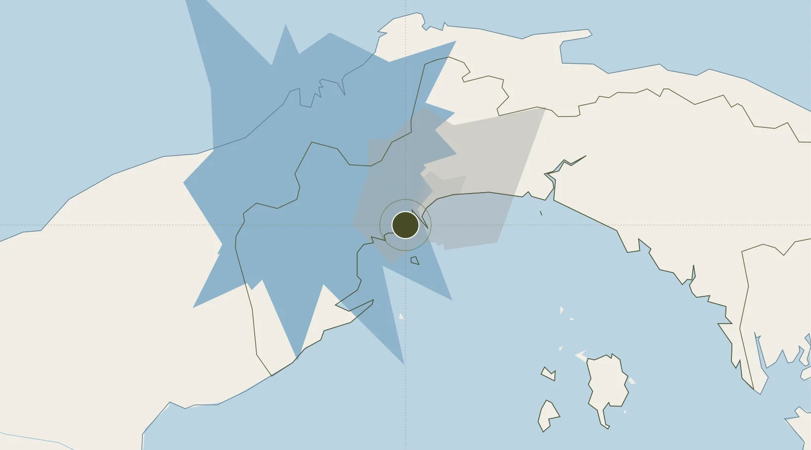
8.9098°, -79.5886°
1,390 ha
Zone area
5.1 km
Nearest port
1.3 km
Nearest airport

Gateway access

Nearest neighbours — logibook spatial index (haversine) over the source coordinates

Zone profile

Zone type
Free Trade Zone
Open Zone Map
Region
Panama
Open Zone Map
Status
Active
Open Zone Map
Management
Public-Private Partnership
Open Zone Map
Operator
London and Regional Panama
Open Zone Map
Legal framework
Law No. 19 of 2001, Law 120 of 2013, and Law No. 8 of April 4, 2016
Open Zone Map

Location

Location of ozm-3072
Natural Earth 10m (public domain) · Panama · ozm-3072 · 8.91, -79.59GoogleOSMYandex

Nearby Logistics Neighbours

Ports
  1. 1Balboa5 km
  2. 2Vacamonte10 km
  3. 3Bahia De Las Minas60 km
  4. 4Puerto Colon60 km
  5. 5Puerto Cristobal61 km
Nearest neighbours — logibook spatial index (haversine) over the source coordinates
Airports
  1. 1Panamá Pacífico International Airport1 km
  2. 2Marcos A. Gelabert International Airport8 km
  3. 3Tocumen International Airport29 km
  4. 4Enrique Adolfo Jimenez Airport58 km
  5. 5Raul Arias Espinoza Airport68 km
Nearest neighbours — logibook spatial index (haversine) over the source coordinates
Cities
  1. 1Howard2 km
  2. 2Rodman5 km
  3. 3Balboa6 km
  4. 4Ancon8 km
  5. 5Panamá, Ciudad de8 km
Nearest neighbours — logibook spatial index (haversine) over the source coordinates
Trade Zones
  1. 1Zona Franca Marpesca Corozal8 km
  2. 2Zona Franca de Albrook9 km
  3. 3City of Knowledge (Ciudad del Saber)10 km
  4. 4Zona Franca Eurofusión12 km
  5. 5Zona Franca de Hewlett Packard13 km
Nearest neighbours — logibook spatial index (haversine) over the source coordinates
DatabookThe Record of Consolidated Knowledge
Panama beyond logistics?
Browse databook

All Sources

Trade ZonesOpen Zone Map
CC BY
Portsthe NGA World Port Index
Public domain (US gov)
AirportsOurAirports
Public domain
LocationsUN/LOCODE
UN/LOCODE — free
← Panama trade zones