UN/LOCODE hub · New Zealand
NZHRB

Hornby

-43.5500°, 172.5333°
8,790
Population
1
Transport functions

Transport Functions

Multimodal
UN/LOCODE

Hub Profile

Place type
Populated place
GeoNames
Region
Canterbury
GeoNames
Population
8,790
GeoNames
Time zone
Pacific/Auckland
GeoNames
Elevation
26 m
GeoNames

Location

Location of NZHRB
Natural Earth 10m (public domain) · Canterbury · NZHRB · -43.55, 172.53GoogleOSMYandex

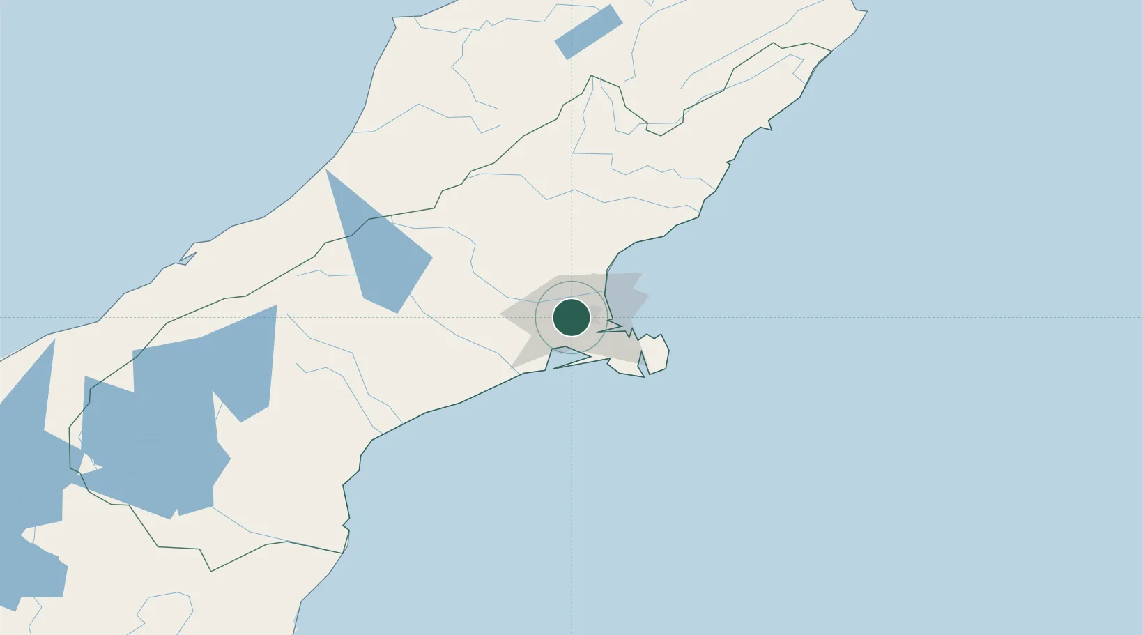
Nearby Logistics Neighbours

Cities
  1. 1Lyttelton11 km
  2. 2Rolleston13 km
  3. 3Clifton18 km
  4. 4Akaroa44 km
  5. 5Timaru138 km
Nearest neighbours — logibook spatial index (haversine) over the source coordinates
Ports
  1. 1Port Lyttelton16 km
  2. 2Akaroa45 km
  3. 3Timaru140 km
  4. 4Greymouth164 km
  5. 5Westport214 km
Nearest neighbours — logibook spatial index (haversine) over the source coordinates
Airports
  1. 1Christchurch International Airport7 km
  2. 2Timaru Airport134 km
  3. 3Hokitika Airfield156 km
  4. 4Mount Cook Airport195 km
  5. 5Oamaru Airport196 km
Nearest neighbours — logibook spatial index (haversine) over the source coordinates
Trade Zones
  1. 1Hicks Bay Area Special Economic Zone813 km
  2. 2Latrobe Valley Economic Growth Zone2265 km
  3. 3Rotuma-Kadavu Tax-Free Region2879 km
  4. 4Kalabu Tax Free Zone2886 km
  5. 5Nausori-Ba Tax-Free Region2893 km
Nearest neighbours — logibook spatial index (haversine) over the source coordinates
DatabookThe Record of Consolidated Knowledge
New Zealand beyond logistics?
Browse databook

All Sources

LocationsUN/LOCODE
UN/LOCODE — free
LocationsGeoNames
CC BY 4.0
Portsthe NGA World Port Index
Public domain (US gov)
AirportsOurAirports
Public domain
Trade Zonesthe World Bank SEZ database
CC BY 4.0
Trade ZonesOpen Zone Map
CC BY
← New Zealand locations