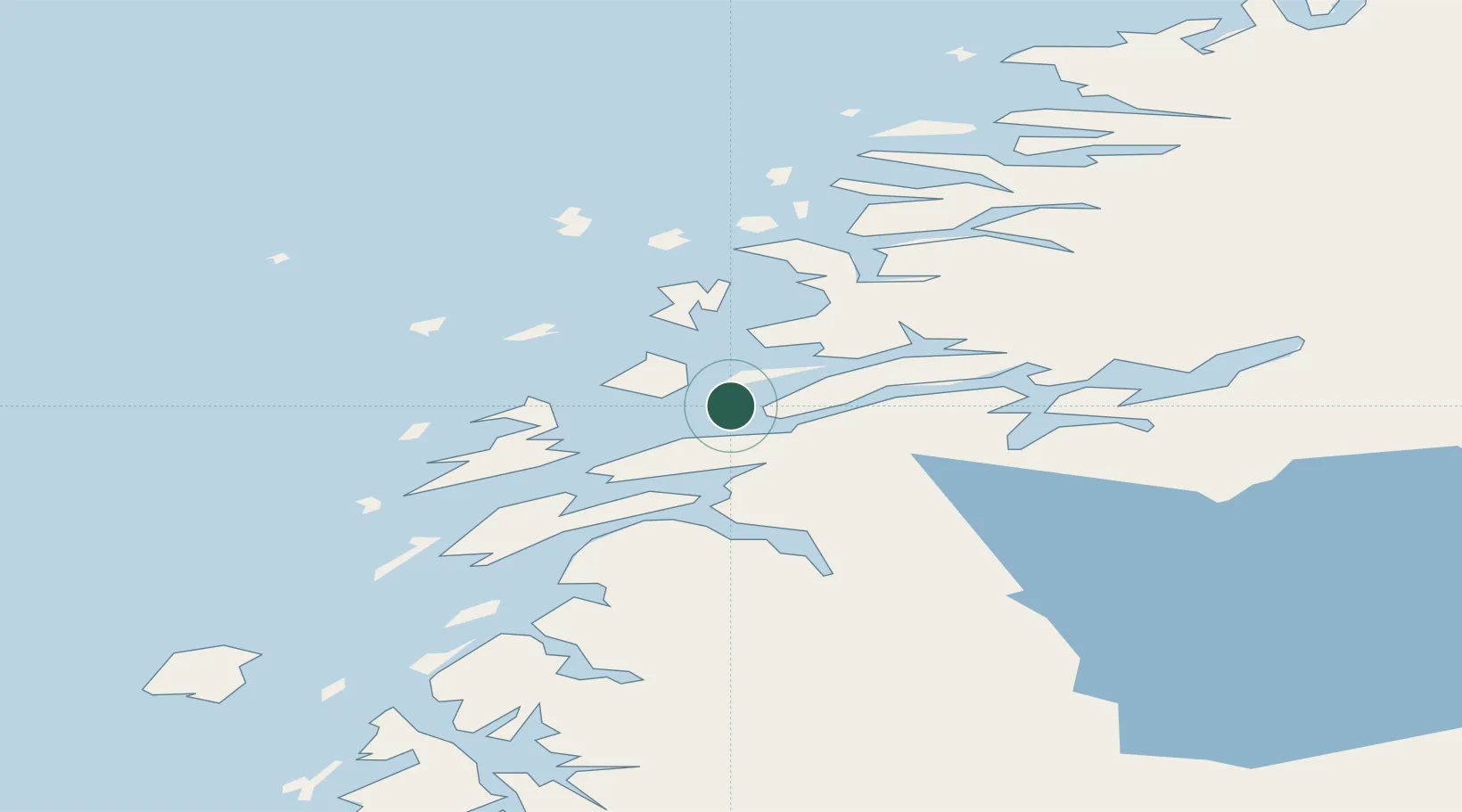
UN/LOCODE hub · Norway
NOVHN

Vikholmen

66.2000°, 12.9667°
1
Transport functions

Transport Functions

Port
UN/LOCODE

Hub Profile

Region
18
GeoNames

Location

Location of NOVHN
Natural Earth 10m (public domain) · 18 · NOVHN · 66.20, 12.97GoogleOSMYandex

Nearby Logistics Neighbours

Cities
  1. 1Nesna2 km
  2. 2Austvika12 km
  3. 3Stokkvågen15 km
  4. 4Leirfjord17 km
  5. 5Lurøy25 km
Nearest neighbours — logibook spatial index (haversine) over the source coordinates
Ports
  1. 1Nesna2 km
  2. 2Sandnessjoen25 km
  3. 3Hemnesberget29 km
  4. 4Mosjoen39 km
  5. 5Tjotta49 km
Nearest neighbours — logibook spatial index (haversine) over the source coordinates
Airports
  1. 1Sandnessjøen Airport, Stokka35 km
  2. 2Mosjøen Airport, Kjærstad48 km
  3. 3Mo i Rana Airport, Røssvoll62 km
  4. 4Brønnøysund Airport, Brønnøy89 km
  5. 5Hemavan Airport105 km
Nearest neighbours — logibook spatial index (haversine) over the source coordinates
Trade Zones
  1. 1Oulu Port Free Warehouse Area586 km
  2. 2Turku Free Zone787 km
  3. 3Stockholm Free Zone805 km
  4. 4Freeport of Hanko865 km
  5. 5Jönköping Free Zone940 km
Nearest neighbours — logibook spatial index (haversine) over the source coordinates
DatabookThe Record of Consolidated Knowledge
Norway beyond logistics?
Browse databook

All Sources

LocationsUN/LOCODE
UN/LOCODE — free
Portsthe NGA World Port Index
Public domain (US gov)
AirportsOurAirports
Public domain
Trade Zonesthe World Bank SEZ database
CC BY 4.0
Trade ZonesOpen Zone Map
CC BY
← Norway locations