UN/LOCODE hub · Norway
NOKBV

Kobbvågen

68.7333°, 14.5333°
1
Transport functions

Transport Functions

Port
UN/LOCODE

Hub Profile

Region
18
GeoNames

Location

Location of NOKBV
Natural Earth 10m (public domain) · 18 · NOKBV · 68.73, 14.53GoogleOSMYandex

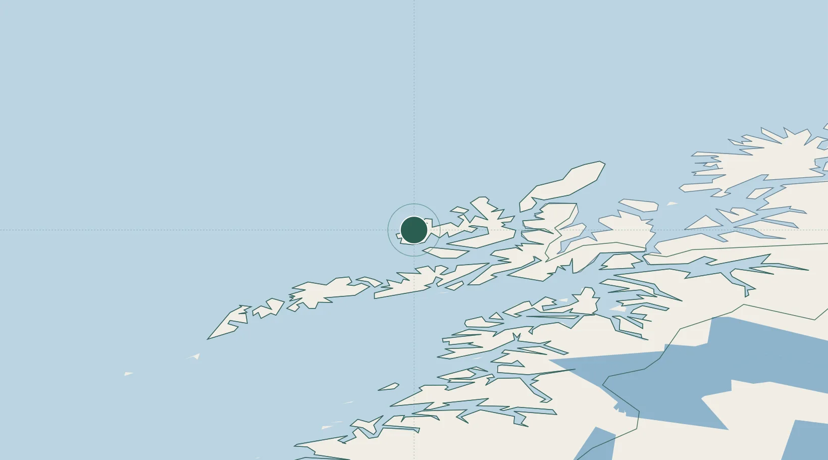
Nearby Logistics Neighbours

Cities
  1. 1Eidet2 km
  2. 2Straumsjøen5 km
  3. 3Straumsnes10 km
  4. 4Steinesjøen15 km
  5. 5Stokmarknes24 km
Nearest neighbours — logibook spatial index (haversine) over the source coordinates
Ports
  1. 1Stokkmarknes24 km
  2. 2Sortland36 km
  3. 3Svolvaer56 km
  4. 4Brettesnes57 km
  5. 5Skrova Havn63 km
Nearest neighbours — logibook spatial index (haversine) over the source coordinates
Airports
  1. 1Stokmarknes Airport, Skagen27 km
  2. 2Svolvær Airport, Helle55 km
  3. 3Leknes Airport75 km
  4. 4Andøya Airport, Andenes89 km
  5. 5Harstad/Narvik Airport91 km
Nearest neighbours — logibook spatial index (haversine) over the source coordinates
Trade Zones
  1. 1Oulu Port Free Warehouse Area630 km
  2. 2Turku Free Zone990 km
  3. 3Stockholm Free Zone1058 km
  4. 4Freeport of Hanko1067 km
  5. 5Port of Hamina-Kotka1088 km
Nearest neighbours — logibook spatial index (haversine) over the source coordinates
DatabookThe Record of Consolidated Knowledge
Norway beyond logistics?
Browse databook

All Sources

LocationsUN/LOCODE
UN/LOCODE — free
Portsthe NGA World Port Index
Public domain (US gov)
AirportsOurAirports
Public domain
Trade Zonesthe World Bank SEZ database
CC BY 4.0
Trade ZonesOpen Zone Map
CC BY
← Norway locations