UN/LOCODE hub · Malaysia
MYPGG

Pengerang

1.3667°, 104.1167°
15,494
Population
1
Transport functions

Transport Functions

Port
UN/LOCODE

Hub Profile

Place type
Populated place
GeoNames
Region
Johor
GeoNames
Population
15,494
GeoNames
Time zone
Asia/Kuala_Lumpur
GeoNames
Elevation
15 m
GeoNames

Location

Location of MYPGG
Natural Earth 10m (public domain) · Johor · MYPGG · 1.37, 104.12GoogleOSMYandex

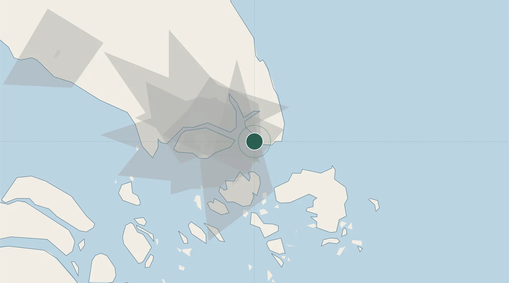
Nearby Logistics Neighbours

Cities
  1. 1Changi14 km
  2. 2Kampung Tanjung Langsat16 km
  3. 3Batu Ampar24 km
  4. 4Batam Island27 km
  5. 5Pasir Gudang, Johor27 km
Nearest neighbours — logibook spatial index (haversine) over the source coordinates
Ports
  1. 1Johor25 km
  2. 2Keppel - (East Singapore)31 km
  3. 3Pulau Sambu33 km
  4. 4Sekupang34 km
  5. 5Tanjunguban35 km
Nearest neighbours — logibook spatial index (haversine) over the source coordinates
Airports
  1. 1Changi Air Base (East)12 km
  2. 2Singapore Changi Airport14 km
  3. 3Paya Lebar Air Base23 km
  4. 4Hang Nadim International Airport27 km
  5. 5Seletar Airport28 km
Nearest neighbours — logibook spatial index (haversine) over the source coordinates
Trade Zones
  1. 1Airport Logistics Park Of Singapore13 km
  2. 2Changi Airport Free Trade Zone14 km
  3. 3Tanjung Langsat Commercial Free Zone19 km
  4. 4Punggol Digital District24 km
  5. 5Union Industrial Park25 km
Nearest neighbours — logibook spatial index (haversine) over the source coordinates
DatabookThe Record of Consolidated Knowledge
Malaysia beyond logistics?
Browse databook

All Sources

LocationsUN/LOCODE
UN/LOCODE — free
LocationsGeoNames
CC BY 4.0
Portsthe NGA World Port Index
Public domain (US gov)
AirportsOurAirports
Public domain
Trade Zonesthe World Bank SEZ database
CC BY 4.0
Trade ZonesOpen Zone Map
CC BY
← Malaysia locations