UN/LOCODE hub · Malaysia
MYTGE

Tanjung Gelang

3.9833°, 103.4167°
2
Transport functions

Transport Functions

Port
Road
UN/LOCODE

Hub Profile

Region
06
GeoNames

Location

Location of MYTGE
Natural Earth 10m (public domain) · 06 · MYTGE · 3.98, 103.42GoogleOSMYandex

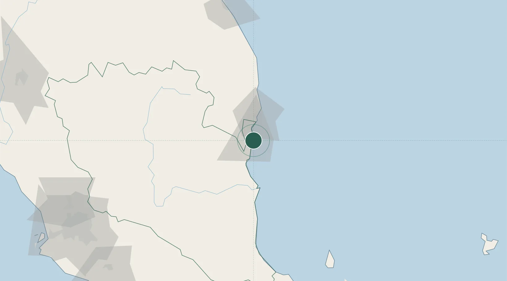
Nearby Logistics Neighbours

Cities
  1. 1Gebeng2 km
  2. 2Kuantan (Tanjong Gelang)4 km
  3. 3Cukai30 km
  4. 4Kertih59 km
  5. 5Kerteh59 km
Nearest neighbours — logibook spatial index (haversine) over the source coordinates
Ports
  1. 1Kuantan New Port3 km
  2. 2Kemaman Harbor30 km
  3. 3Kuala Trengganu155 km
  4. 4Belida Marine Terminal191 km
  5. 5Muar235 km
Nearest neighbours — logibook spatial index (haversine) over the source coordinates
Airports
  1. 1Kuantan Airport33 km
  2. 2Kerteh Airport62 km
  3. 3Tioman Airport154 km
  4. 4Sultan Mahmud Airport159 km
  5. 5Kluang Airport216 km
Nearest neighbours — logibook spatial index (haversine) over the source coordinates
Trade Zones
  1. 1Kuantan Port Free Zone, Pahang1 km
  2. 2Kenyir Lake Free Zone, Terengganu146 km
  3. 3Senawang Industrial Park216 km
  4. 4Galla Industrial Park219 km
  5. 5Pedas Halal Park (Miel)219 km
Nearest neighbours — logibook spatial index (haversine) over the source coordinates
DatabookThe Record of Consolidated Knowledge
Malaysia beyond logistics?
Browse databook

All Sources

LocationsUN/LOCODE
UN/LOCODE — free
Portsthe NGA World Port Index
Public domain (US gov)
AirportsOurAirports
Public domain
Trade Zonesthe World Bank SEZ database
CC BY 4.0
Trade ZonesOpen Zone Map
CC BY
← Malaysia locations