UN/LOCODE hub · Mexico
MXTUX

Tuxpan

20.9592°, -97.3272°
2,086
Population
1
Transport functions
1
Container terminals

Transport Functions

Port
Tuxpan is also a profiled seaport →
UN/LOCODE

Hub Profile

Place type
Populated place
GeoNames
Region
Guerrero
GeoNames
Population
2,086
GeoNames
Time zone
America/Mexico_City
GeoNames
Elevation
762 m
GeoNames
Logistics facilities
2
UN/LOCODE
Container terminals
1
UN/LOCODE

Location

Location of MXTUX
Natural Earth 10m (public domain) · Guerrero · MXTUX · 20.96, -97.33GoogleOSMYandex

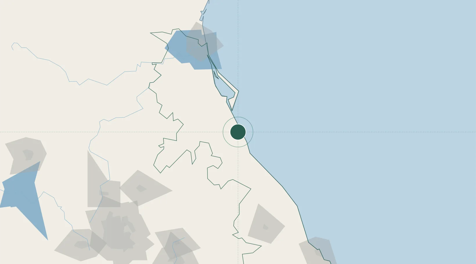
Nearby Logistics Neighbours

Cities
  1. 1Temapache34 km
  2. 2Tihuatlán36 km
  3. 3Papantla59 km
  4. 4Nautla100 km
  5. 5Tantoyuca104 km
Nearest neighbours — logibook spatial index (haversine) over the source coordinates
Ports
  1. 1Tampico151 km
  2. 2Altamira178 km
  3. 3Veracruz232 km
  4. 4Coatzacoalcos437 km
  5. 5Nanchital443 km
Nearest neighbours — logibook spatial index (haversine) over the source coordinates
Trade Zones
  1. 1Special Economic Zone of Coatzacoalcos432 km
  2. 2Zona Economica Especial de Tabasco511 km
  3. 3FTZ No. 062 Brownsville555 km
  4. 4Special Economic Zone of Salina Cruz577 km
  5. 5FTZ No. 156 Weslaco582 km
Nearest neighbours — logibook spatial index (haversine) over the source coordinates
DatabookThe Record of Consolidated Knowledge
Mexico beyond logistics?
Browse databook

All Sources

LocationsUN/LOCODE
UN/LOCODE — free
LocationsGeoNames
CC BY 4.0
Portsthe NGA World Port Index
Public domain (US gov)
AirportsOurAirports
Public domain
Trade Zonesthe World Bank SEZ database
CC BY 4.0
Trade ZonesOpen Zone Map
CC BY
← Mexico locations