UN/LOCODE hub · South Korea
KRSHG

Sinhang/Pohang

36.0833°, 129.5500°
2
Transport functions

Transport Functions

Port
Road
UN/LOCODE

Hub Profile

Region
48
GeoNames

Location

Location of KRSHG
Natural Earth 10m (public domain) · 48 · KRSHG · 36.08, 129.55GoogleOSMYandex

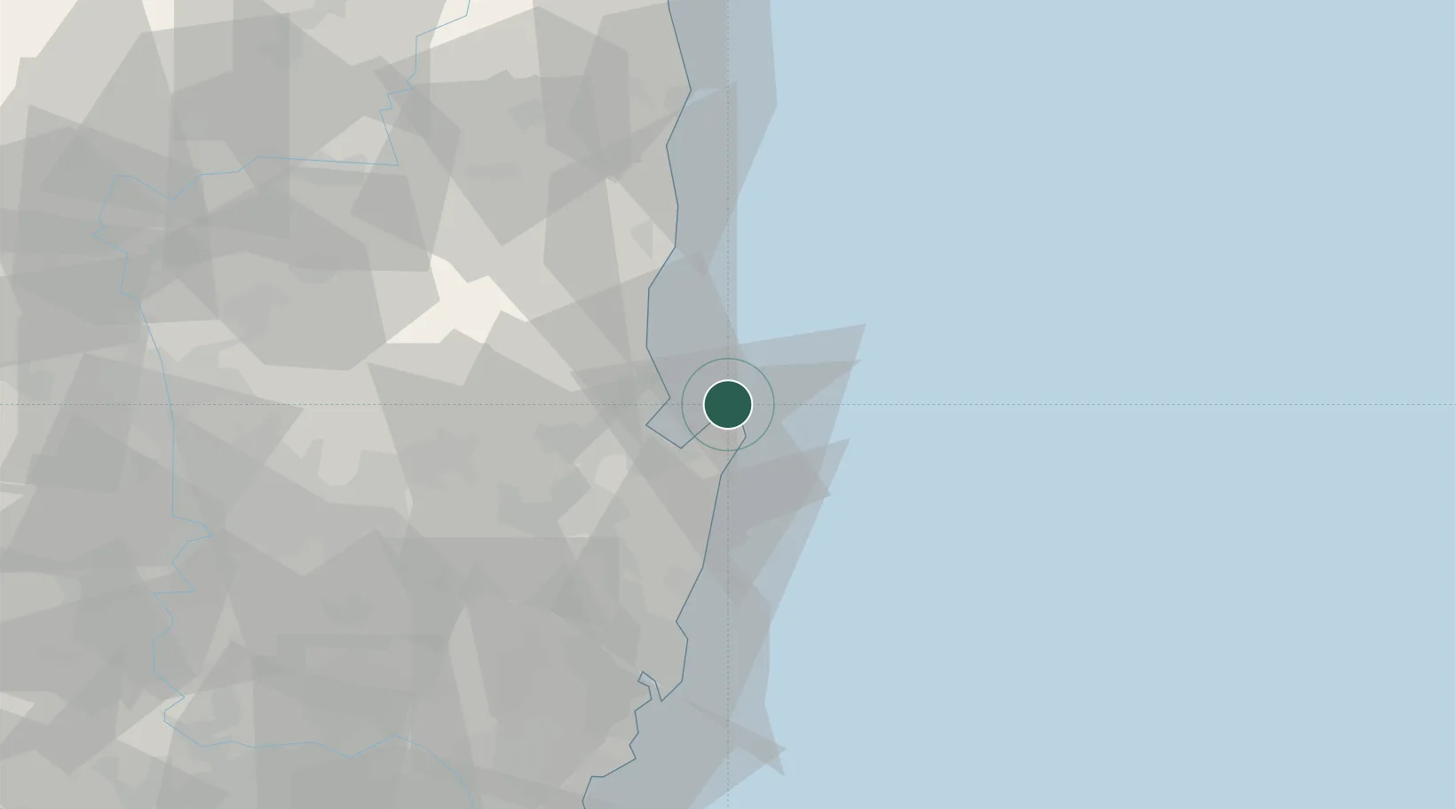
Nearby Logistics Neighbours

Cities
  1. 1Pohang10 km
  2. 2Guryongpo11 km
  3. 3Ganggu33 km
  4. 4Yeongdeok-gun40 km
  5. 5Gyeongju40 km
Nearest neighbours — logibook spatial index (haversine) over the source coordinates
Ports
  1. 1Pohang15 km
  2. 2Ulsan72 km
  3. 3Busan119 km
  4. 4Chinae133 km
  5. 5Masan134 km
Nearest neighbours — logibook spatial index (haversine) over the source coordinates
Airports
  1. 1Pohang Airport (G-815/K-3)16 km
  2. 2Ulsan Airport57 km
  3. 3Daegu International Airport83 km
  4. 4Gimhae International Airport115 km
  5. 5Yecheon Airbase124 km
Nearest neighbours — logibook spatial index (haversine) over the source coordinates
Trade Zones
  1. 1Pohang Fusion Tech District19 km
  2. 2Pohang Port Free Trade Zone19 km
  3. 3Pohang Foreign Investment Zone20 km
  4. 4Pohang 4 (GIC - includes FIZ)20 km
  5. 5Yeongcheon Industry District58 km
Nearest neighbours — logibook spatial index (haversine) over the source coordinates
DatabookThe Record of Consolidated Knowledge
South Korea beyond logistics?
Browse databook

All Sources

LocationsUN/LOCODE
UN/LOCODE — free
Portsthe NGA World Port Index
Public domain (US gov)
AirportsOurAirports
Public domain
Trade Zonesthe World Bank SEZ database
CC BY 4.0
Trade ZonesOpen Zone Map
CC BY
← South Korea locations