UN/LOCODE hub · Japan
JPICW

Ishikariwan Shinko

43.1899°, 141.2944°
1
Transport functions

Transport Functions

Port
UN/LOCODE

Hub Profile

Logistics facilities
1
UN/LOCODE

Location

Location of JPICW
Natural Earth 10m (public domain) · Hokkaidō · JPICW · 43.19, 141.29GoogleOSMYandex

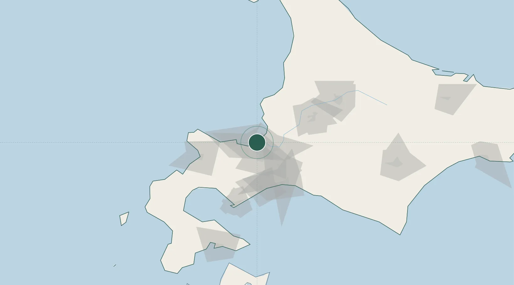
Nearby Logistics Neighbours

Cities
  1. 1Ishikari0 km
  2. 2Sapporo14 km
  3. 3Iwamizawa37 km
  4. 4Kutchan56 km
  5. 5Takikawa, Hokkaido63 km
Nearest neighbours — logibook spatial index (haversine) over the source coordinates
Ports
  1. 1Ishikari Bay New Port3 km
  2. 2Otaru Ko23 km
  3. 3Wakkanai40 km
  4. 4Tomakomai Ko68 km
  5. 5Rumoi Ko89 km
Nearest neighbours — logibook spatial index (haversine) over the source coordinates
Airports
  1. 1Sapporo Okadama Airport11 km
  2. 2JASDF Chitose Air Base53 km
  3. 3New Chitose Airport56 km
  4. 4Asahikawa Airport107 km
  5. 5Tokachi Airport155 km
Nearest neighbours — logibook spatial index (haversine) over the source coordinates
DatabookThe Record of Consolidated Knowledge
Japan beyond logistics?
Browse databook

All Sources

LocationsUN/LOCODE
UN/LOCODE — free
Portsthe NGA World Port Index
Public domain (US gov)
AirportsOurAirports
Public domain
Trade Zonesthe World Bank SEZ database
CC BY 4.0
Trade ZonesOpen Zone Map
CC BY
← Japan locations