UN/LOCODE hub · Japan
JPTIW

Takikawa, Hokkaido

43.5500°, 141.9000°
1
Transport functions

Transport Functions

Multimodal
UN/LOCODE

Hub Profile

Region
01
GeoNames

Location

Location of JPTIW
Natural Earth 10m (public domain) · 01 · JPTIW · 43.55, 141.90GoogleOSMYandex

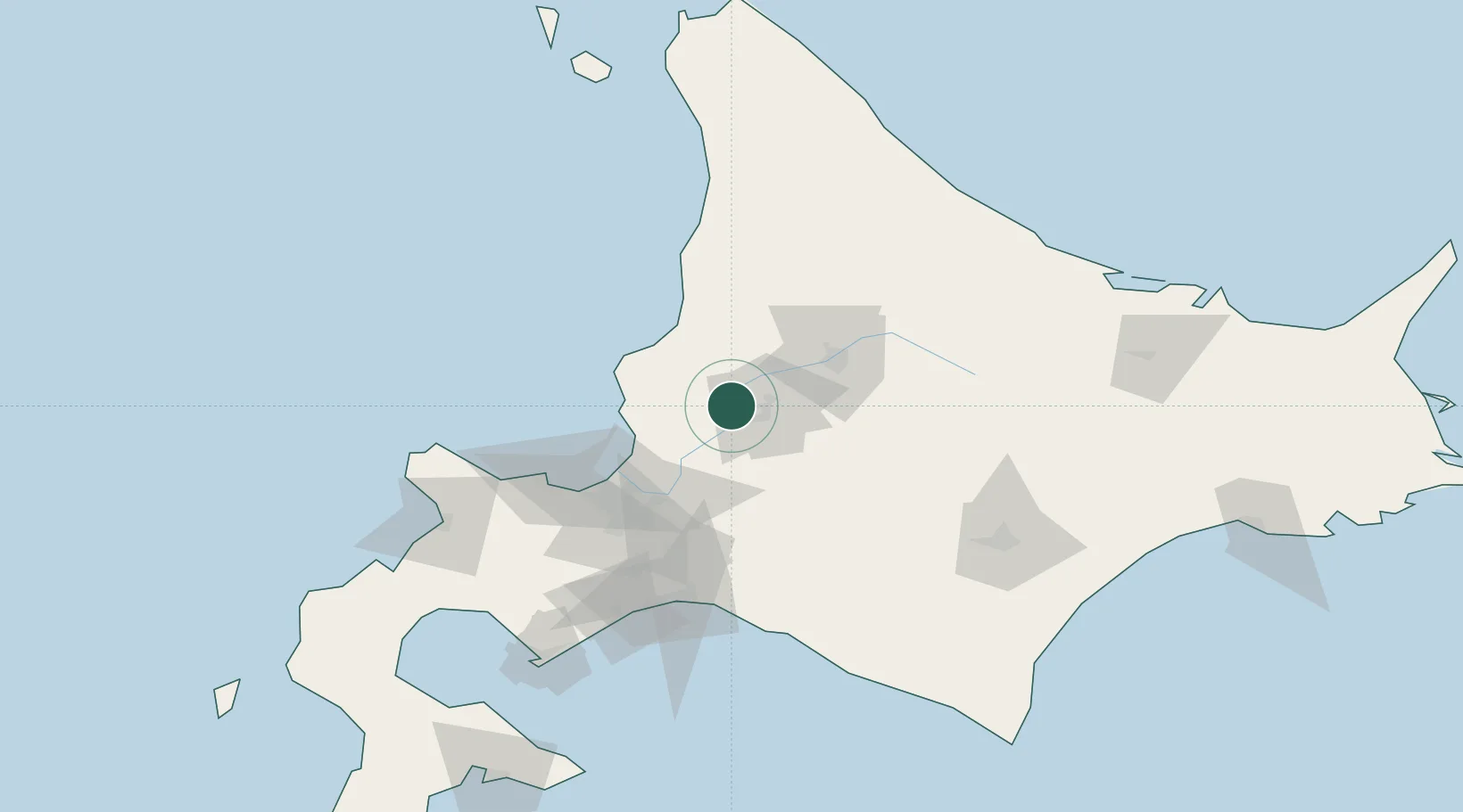
Nearby Logistics Neighbours

Cities
  1. 1Iwamizawa41 km
  2. 2Ishikariwan Shinko63 km
  3. 3Ishikari63 km
  4. 4Sapporo70 km
  5. 5Tomakomai104 km
Nearest neighbours — logibook spatial index (haversine) over the source coordinates
Ports
  1. 1Wakkanai23 km
  2. 2Rumoi Ko49 km
  3. 3Ishikari Bay New Port62 km
  4. 4Otaru Ko81 km
  5. 5Tomakomai Ko104 km
Nearest neighbours — logibook spatial index (haversine) over the source coordinates
Airports
  1. 1Asahikawa Airport46 km
  2. 2Sapporo Okadama Airport64 km
  3. 3JASDF Chitose Air Base86 km
  4. 4New Chitose Airport88 km
  5. 5Tokachi Airport126 km
Nearest neighbours — logibook spatial index (haversine) over the source coordinates
DatabookThe Record of Consolidated Knowledge
Japan beyond logistics?
Browse databook

All Sources

LocationsUN/LOCODE
UN/LOCODE — free
Portsthe NGA World Port Index
Public domain (US gov)
AirportsOurAirports
Public domain
Trade Zonesthe World Bank SEZ database
CC BY 4.0
Trade ZonesOpen Zone Map
CC BY
← Japan locations