UN/LOCODE hub · India
INSPC

Cclpil Sez/Visakhapatnam

13.2167°, 79.0333°
1
Transport functions

Transport Functions

Multimodal
UN/LOCODE

Hub Profile

Region
AP
GeoNames

Location

Location of INSPC
Natural Earth 10m (public domain) · AP · INSPC · 13.22, 79.03GoogleOSMYandex

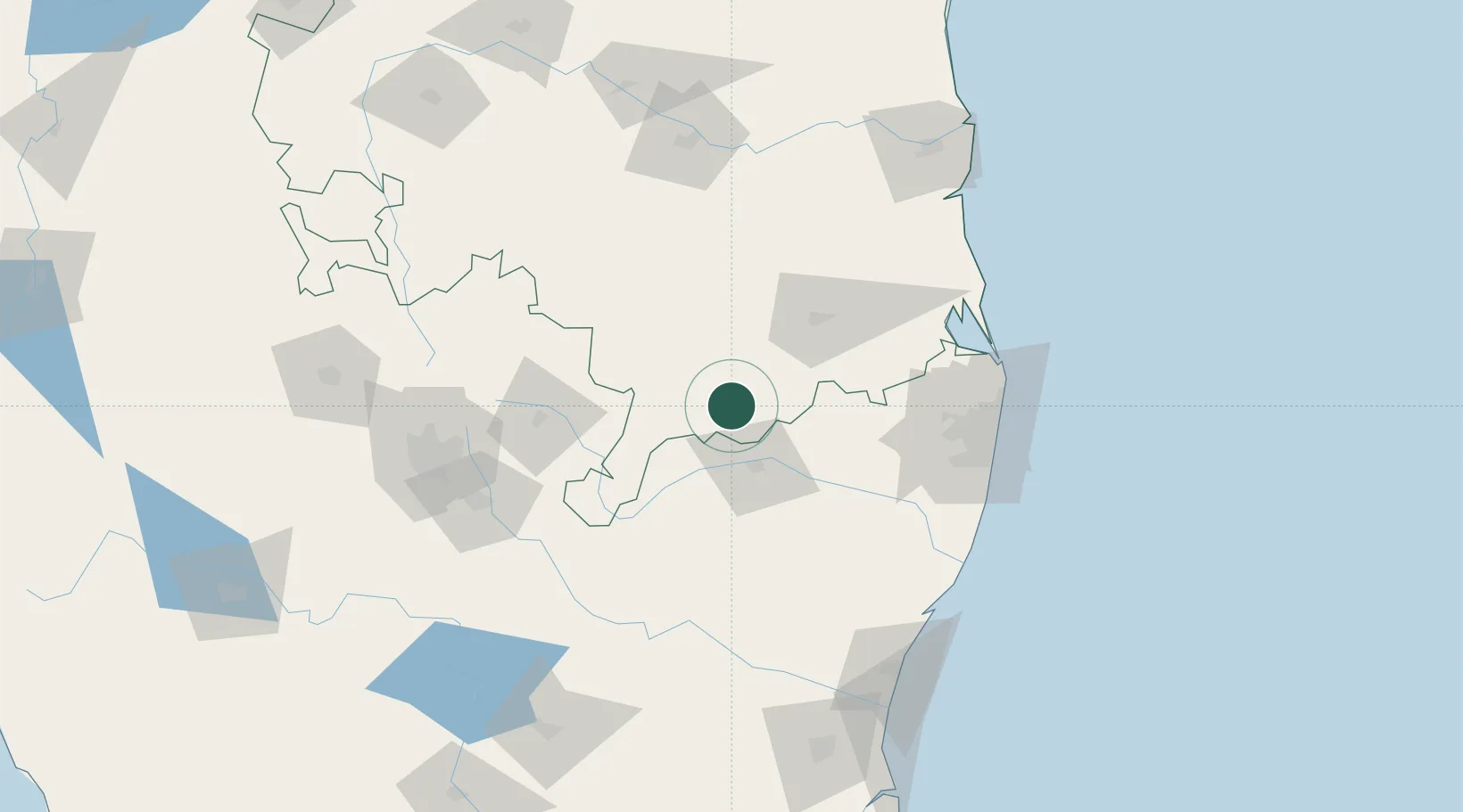
Nearby Logistics Neighbours

Cities
  1. 1Chittoor8 km
  2. 2SIPC SEZ/Vellore33 km
  3. 3Cheyyar-SEZ/Vellore33 km
  4. 4Renigunta71 km
  5. 5FIPL SEZ/Kancheepuram85 km
Nearest neighbours — logibook spatial index (haversine) over the source coordinates
Ports
  1. 1Chennai (Madras)138 km
  2. 2Kamarajar Port142 km
  3. 3Kattupalli Port165 km
  4. 4Pondicherry167 km
  5. 5Cuddalore185 km
Nearest neighbours — logibook spatial index (haversine) over the source coordinates
Airports
  1. 1Tirupati International Airport72 km
  2. 2Chennai International Airport126 km
  3. 3Kempegowda International Airport Bengaluru144 km
  4. 4Kadapa Airport147 km
  5. 5HAL Airport151 km
Nearest neighbours — logibook spatial index (haversine) over the source coordinates
Trade Zones
  1. 1Flextronics Technologies (India) Private Limited101 km
  2. 2Sri City107 km
  3. 3Mahindra City Special Economic Zone119 km
  4. 4MEPZ Special Economic Zone122 km
  5. 5DLF Info City126 km
Nearest neighbours — logibook spatial index (haversine) over the source coordinates
DatabookThe Record of Consolidated Knowledge
India beyond logistics?
Browse databook

All Sources

LocationsUN/LOCODE
UN/LOCODE — free
Portsthe NGA World Port Index
Public domain (US gov)
AirportsOurAirports
Public domain
Trade Zonesthe World Bank SEZ database
CC BY 4.0
Trade ZonesOpen Zone Map
CC BY
← India locations