UN/LOCODE hub · India
INBLG

Balanagar

16.9667°, 78.1667°
1
Transport functions

Transport Functions

Multimodal
UN/LOCODE

Hub Profile

Place type
Populated place
GeoNames
Region
Telangana
GeoNames
Time zone
Asia/Kolkata
GeoNames
Elevation
567 m
GeoNames

Location

Location of INBLG
Natural Earth 10m (public domain) · Telangana · INBLG · 16.97, 78.17GoogleOSMYandex

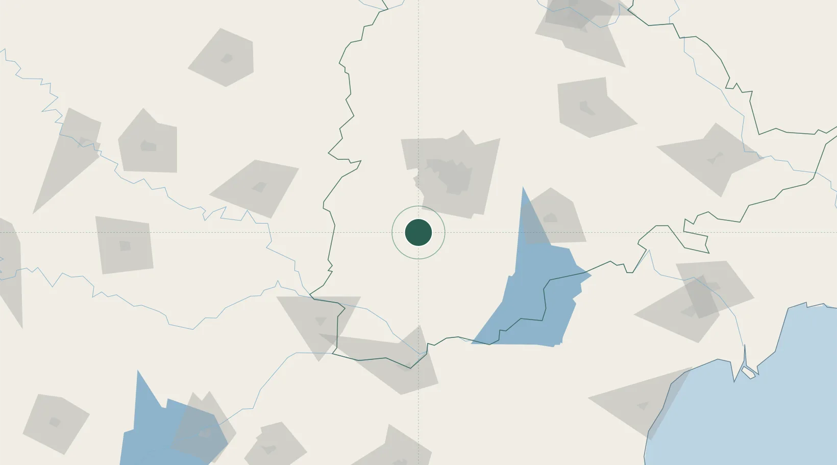
Nearby Logistics Neighbours

Cities
  1. 1CMTL ICD/Thimmapur25 km
  2. 2APIICL-SEZ/Mahabaoobnagar33 km
  3. 3APIICL-SEZ/Ranga Reddy55 km
  4. 4Hgsezl-SEZ/Ranga Reddy55 km
  5. 5ITL SEZ/Ranga Reddy60 km
Nearest neighbours — logibook spatial index (haversine) over the source coordinates
Ports
  1. 1Kattupalli Port368 km
  2. 2Kakinada Bay441 km
  3. 3Kamarajar Port474 km
  4. 4Chennai (Madras)487 km
  5. 5Belekeri487 km
Nearest neighbours — logibook spatial index (haversine) over the source coordinates
Airports
  1. 1Rajiv Gandhi International Airport41 km
  2. 2Begumpet Airport63 km
  3. 3Dundigul Air Force Academy78 km
  4. 4Bidar Airport / Bidar Air Force Station127 km
  5. 5Kalaburagi Airport133 km
Nearest neighbours — logibook spatial index (haversine) over the source coordinates
Trade Zones
  1. 1Apiic Pharma SEZ - Jedcherla23 km
  2. 2Jt Holdings Pvt Ltd, Rr Dist.34 km
  3. 3GMR Hyderabad International Airport Limted42 km
  4. 4TCSl Ltd, Adibatla51 km
  5. 5DLF Commercial Developers Ltd, Gachibowli52 km
Nearest neighbours — logibook spatial index (haversine) over the source coordinates
DatabookThe Record of Consolidated Knowledge
India beyond logistics?
Browse databook

All Sources

LocationsUN/LOCODE
UN/LOCODE — free
Portsthe NGA World Port Index
Public domain (US gov)
AirportsOurAirports
Public domain
Trade Zonesthe World Bank SEZ database
CC BY 4.0
Trade ZonesOpen Zone Map
CC BY
← India locations