UN/LOCODE hub · Indonesia
IDTPN

Tanjung Pemancingan

-3.1833°, 116.2667°
1
Transport functions

Transport Functions

Port
UN/LOCODE

Hub Profile

Region
KS
GeoNames

Location

Location of IDTPN
Natural Earth 10m (public domain) · KS · IDTPN · -3.18, 116.27GoogleOSMYandex

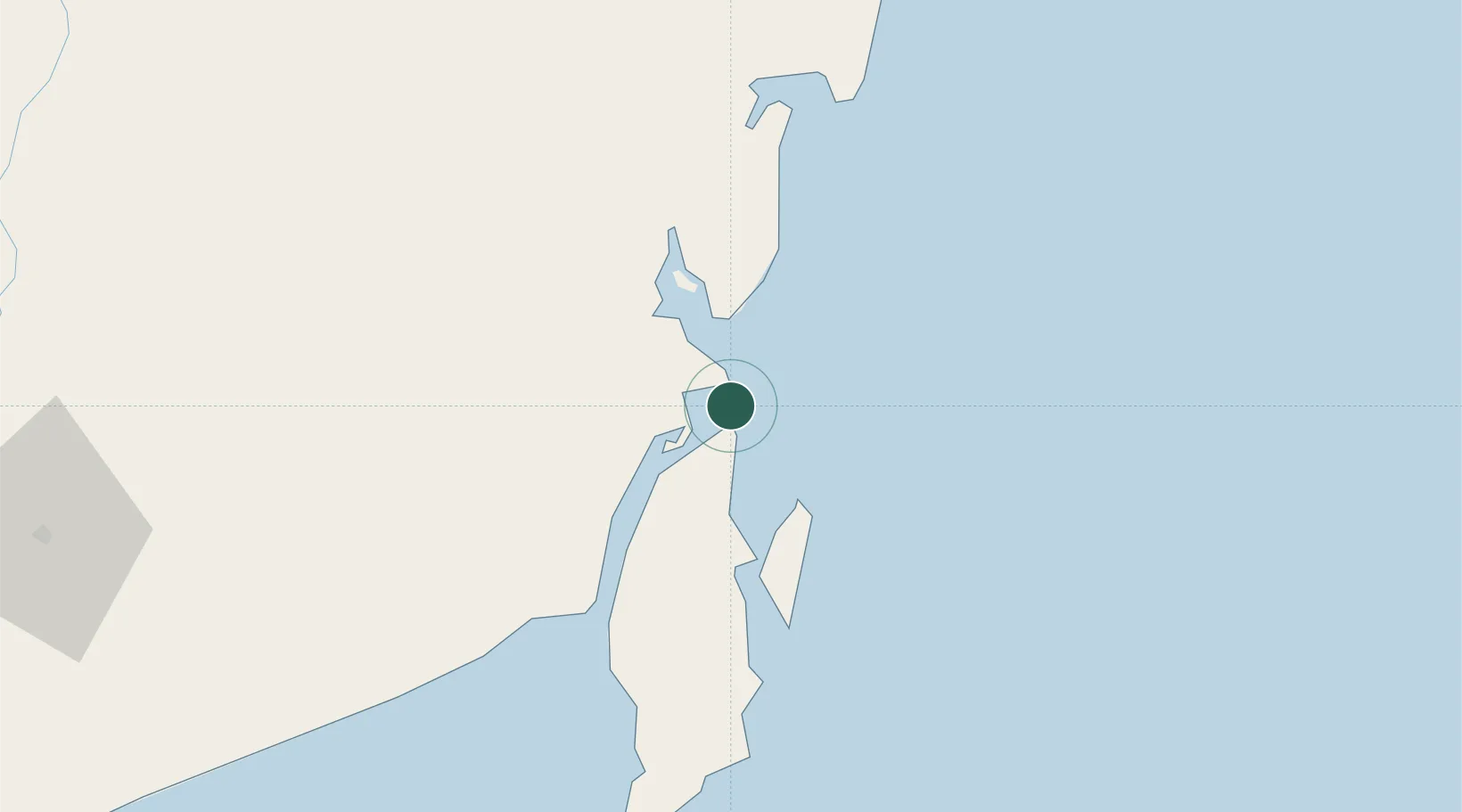
Nearby Logistics Neighbours

Cities
  1. 1North Pulau Laut4 km
  2. 2Setagin16 km
  3. 3Pulau Laut17 km
  4. 4Tarjun22 km
  5. 5Sebuku Island37 km
Nearest neighbours — logibook spatial index (haversine) over the source coordinates
Ports
  1. 1North Pulau Laut Coal Terminal3 km
  2. 2Kota Baru8 km
  3. 3Stagen18 km
  4. 4Gunung Batu Besar63 km
  5. 5Tanah Merah152 km
Nearest neighbours — logibook spatial index (haversine) over the source coordinates
Airports
  1. 1Gusti Syamsir Alam Airport17 km
  2. 2Bersujud Airport40 km
  3. 3Warukin Airport142 km
  4. 4Syamsudin Noor International Airport170 km
  5. 5Sultan Aji Muhammad Sulaiman Sepinggan International Airport224 km
Nearest neighbours — logibook spatial index (haversine) over the source coordinates
Trade Zones
  1. 1Kariangau Industrial Estate222 km
  2. 2Kaltim Industrial Estate398 km
  3. 3Delma Industrial Park414 km
  4. 4Kawasan Industri Makassar417 km
  5. 5Terpadu Takalar Industrial Estate432 km
Nearest neighbours — logibook spatial index (haversine) over the source coordinates
DatabookThe Record of Consolidated Knowledge
Indonesia beyond logistics?
Browse databook

All Sources

LocationsUN/LOCODE
UN/LOCODE — free
Portsthe NGA World Port Index
Public domain (US gov)
AirportsOurAirports
Public domain
Trade Zonesthe World Bank SEZ database
CC BY 4.0
Trade ZonesOpen Zone Map
CC BY
← Indonesia locations