UN/LOCODE hub · Indonesia
IDTAR

Tarjun

-3.2667°, 116.0833°
1
Transport functions

Transport Functions

Port
UN/LOCODE

Hub Profile

Place type
Populated place
GeoNames
Region
South Kalimantan
GeoNames
Time zone
Asia/Makassar
GeoNames
Elevation
8 m
GeoNames

Location

Location of IDTAR
Natural Earth 10m (public domain) · South Kalimantan · IDTAR · -3.27, 116.08GoogleOSMYandex

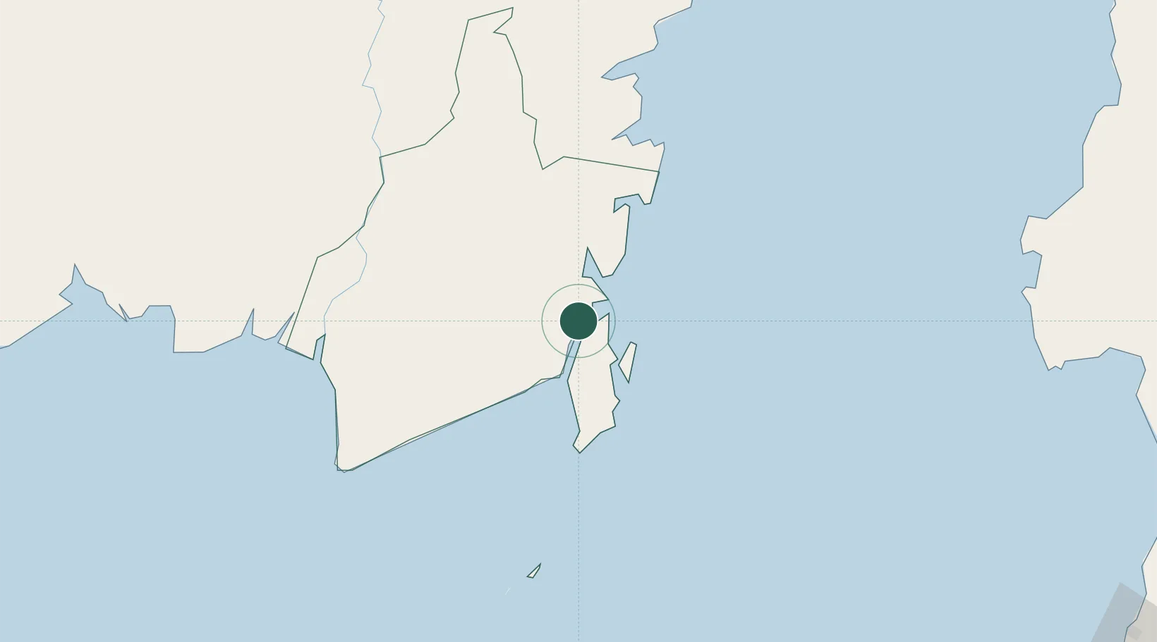
Nearby Logistics Neighbours

Cities
  1. 1Pulau Laut8 km
  2. 2Setagin9 km
  3. 3North Pulau Laut21 km
  4. 4Tanjung Pemancingan22 km
  5. 5Batulicin23 km
Nearest neighbours — logibook spatial index (haversine) over the source coordinates
Ports
  1. 1Stagen8 km
  2. 2Kota Baru15 km
  3. 3North Pulau Laut Coal Terminal23 km
  4. 4Gunung Batu Besar76 km
  5. 5Tanah Merah162 km
Nearest neighbours — logibook spatial index (haversine) over the source coordinates
Airports
  1. 1Gusti Syamsir Alam Airport10 km
  2. 2Bersujud Airport19 km
  3. 3Warukin Airport137 km
  4. 4Syamsudin Noor International Airport148 km
  5. 5Sultan Aji Muhammad Sulaiman Sepinggan International Airport240 km
Nearest neighbours — logibook spatial index (haversine) over the source coordinates
Trade Zones
  1. 1Kariangau Industrial Estate237 km
  2. 2Kaltim Industrial Estate414 km
  3. 3Delma Industrial Park425 km
  4. 4Kawasan Industri Makassar430 km
  5. 5Terpadu Takalar Industrial Estate443 km
Nearest neighbours — logibook spatial index (haversine) over the source coordinates
DatabookThe Record of Consolidated Knowledge
Indonesia beyond logistics?
Browse databook

All Sources

LocationsUN/LOCODE
UN/LOCODE — free
Portsthe NGA World Port Index
Public domain (US gov)
AirportsOurAirports
Public domain
Trade Zonesthe World Bank SEZ database
CC BY 4.0
Trade ZonesOpen Zone Map
CC BY
← Indonesia locations