UN/LOCODE hub · United Kingdom
GBTAR

Tarbert, Loch Fyne

55.8667°, -5.4167°
2
Transport functions

Transport Functions

Port
Road
Tarbert, Loch Fyne is also a profiled seaport →
UN/LOCODE

Hub Profile

Region
AGB
GeoNames

Location

Location of GBTAR
Natural Earth 10m (public domain) · AGB · GBTAR · 55.87, -5.42GoogleOSMYandex

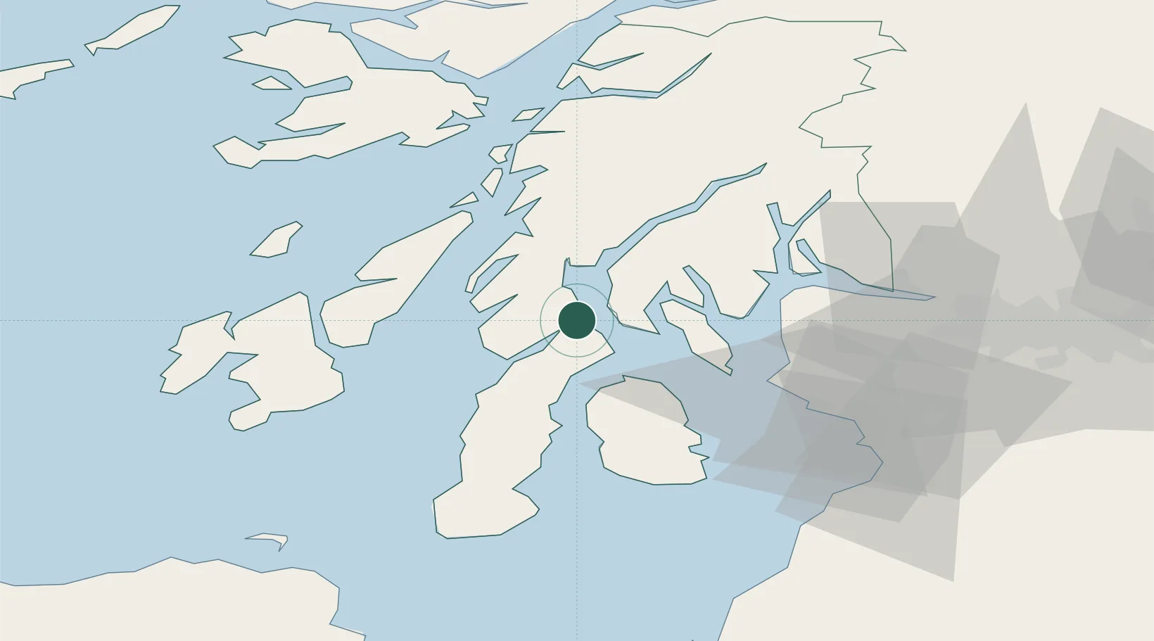
Nearby Logistics Neighbours

Cities
  1. 1West Loch Tarbert2 km
  2. 2Portavadie7 km
  3. 3Kennacraig8 km
  4. 4Tighnabruaich12 km
  5. 5Kyles of Bute13 km
Nearest neighbours — logibook spatial index (haversine) over the source coordinates
Ports
  1. 1Ardrishaig17 km
  2. 2Rothesay Harbor23 km
  3. 3Crinan (Canal)26 km
  4. 4Millport34 km
  5. 5Largs35 km
Nearest neighbours — logibook spatial index (haversine) over the source coordinates
Airports
  1. 1Campbeltown Airport51 km
  2. 2Colonsay Airstrip56 km
  3. 3Islay Airport56 km
  4. 4Glasgow Airport61 km
  5. 5Oban Airport66 km
Nearest neighbours — logibook spatial index (haversine) over the source coordinates
Trade Zones
  1. 1Prestwick Airport Free Zone64 km
  2. 2Carlisle Kingmoor Park Enterprise Zone186 km
  3. 3Isle of Man Free Zone and Business Park204 km
  4. 4Blackpool Enterprise Zone278 km
  5. 5Hillhouse Enterprise Zone281 km
Nearest neighbours — logibook spatial index (haversine) over the source coordinates
DatabookThe Record of Consolidated Knowledge
United Kingdom beyond logistics?
Browse databook

All Sources

LocationsUN/LOCODE
UN/LOCODE — free
Portsthe NGA World Port Index
Public domain (US gov)
AirportsOurAirports
Public domain
Trade Zonesthe World Bank SEZ database
CC BY 4.0
Trade ZonesOpen Zone Map
CC BY
← United Kingdom locations