UN/LOCODE hub · United Kingdom
GBSSK

Shiskine

55.5167°, -5.3000°
2
Transport functions

Transport Functions

Port
Road
UN/LOCODE

Hub Profile

Place type
Populated place
GeoNames
Region
Scotland
GeoNames
Time zone
Europe/London
GeoNames
Elevation
30 m
GeoNames

Location

Location of GBSSK
Natural Earth 10m (public domain) · Scotland · GBSSK · 55.52, -5.30GoogleOSMYandex

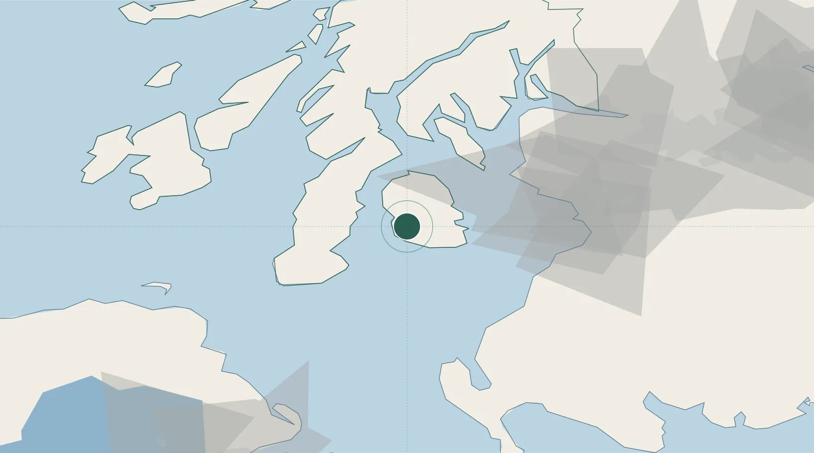
Nearby Logistics Neighbours

Cities
  1. 1Lamlash10 km
  2. 2Brodick, Isle of Arran11 km
  3. 3Carradale13 km
  4. 4Lochranza, Isle of Arran20 km
  5. 5Campbeltown23 km
Nearest neighbours — logibook spatial index (haversine) over the source coordinates
Ports
  1. 1Lamlash Harbor12 km
  2. 2Campbeltown21 km
  3. 3Ardrossan34 km
  4. 4Millport35 km
  5. 5Hunterston37 km
Nearest neighbours — logibook spatial index (haversine) over the source coordinates
Airports
  1. 1Campbeltown Airport26 km
  2. 2Glasgow Prestwick Airport46 km
  3. 3Islay Airport63 km
  4. 4Glasgow Airport67 km
  5. 5Colonsay Airstrip84 km
Nearest neighbours — logibook spatial index (haversine) over the source coordinates
Trade Zones
  1. 1Prestwick Airport Free Zone43 km
  2. 2Carlisle Kingmoor Park Enterprise Zone162 km
  3. 3Isle of Man Free Zone and Business Park164 km
  4. 4Blackpool Enterprise Zone243 km
  5. 5Hillhouse Enterprise Zone245 km
Nearest neighbours — logibook spatial index (haversine) over the source coordinates
DatabookThe Record of Consolidated Knowledge
United Kingdom beyond logistics?
Browse databook

All Sources

LocationsUN/LOCODE
UN/LOCODE — free
Portsthe NGA World Port Index
Public domain (US gov)
AirportsOurAirports
Public domain
Trade Zonesthe World Bank SEZ database
CC BY 4.0
Trade ZonesOpen Zone Map
CC BY
← United Kingdom locations